Catalog Archive
Auction 164, Lot 649

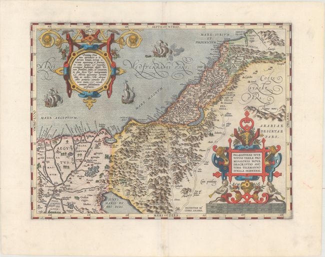
"Palaestinae sive Totius Terrae Promissionis Nova Descriptio Auctore Tilemanno Stella Sigenensi", Ortelius, Abraham

Subject: Holy Land

Period: 1603 (published)

Publication: Theatrum Orbis Terrarum

Color: Hand Color

Size:
17.8 x 13.4 inches
45.2 x 34 cm
Download High Resolution Image
(or just click on image to launch the Zoom viewer)

This is Ortelius' third map of the Holy Land. It covers the region from the Nile Delta to Lebanon, and focuses on the desert of the Exodus. Ortelius' map was based on Tilemanno Stella's map of 1557 that became the prototype for the modern cartography of the Holy Land. Stella adapted the coastline and Dead Sea from the configuration of Jacob Ziegler's map of 1532. But here, Ortelius rounds Stella's angular Dead Sea and the Gulf of Aqaba. The map is richly decorated with two elaborate, neoclassical cartouches. The sea is teaming with three ships (one of which is shown with canons firing). This example is from the third of three plates used for the Theatrum. Latin text on verso.

References: Nebenzahl (HL) pp. 84-86; Laor #539; Tooley (TMC-3) p. 28; Van den Broecke #172.

Condition: A

A sharp impression on a clean, bright sheet with the horn coat of arms watermark that is commonly seen on Ortelius' maps. There is a minor crease adjacent to the centerfold and a professionally repaired centerfold separation confined to the bottom blank margin.

Estimate: $800 - $950

Sold for: $800

Closed on 9/13/2017

Archived