Catalog Archive
Auction 164, Lot 512

"Nouvelle Carte qui Comprend les Principaux Triangles qui Servent de Fondement a la Description Geometrique de la France...", Cassini de Thury, Cesar Francois
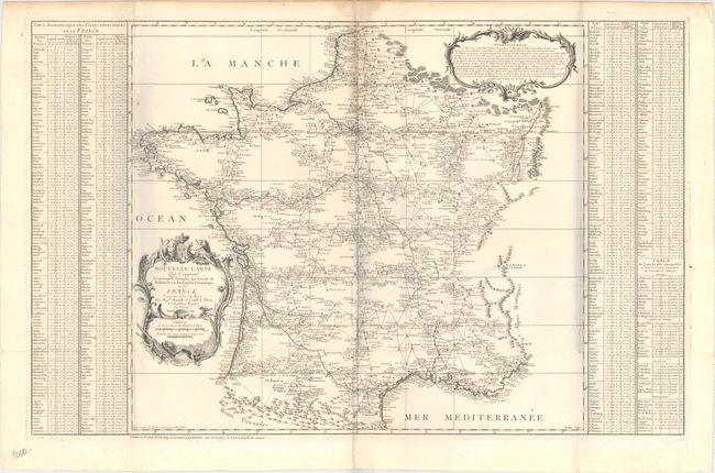
Subject: France

Period: 1744 (dated)

Publication:

Color: Black & White

Size:
35.6 x 22.7 inches
90.4 x 57.7 cm
Download High Resolution Image
(or just click on image to launch the Zoom viewer)

This large format map presents a geometric triangulation of France based on a pattern adopted by Giovanni Maraldi and Cassini de Thury, who conducted a survey of France from 1733-40. Cassini de Thury published 18 triangulated maps of each region of France, which could be joined to create a large wall map of the country. At the same time, Cassini de Thury published this reduced sized map of France and presented it to the Academie des Sciences. The cartography is kept fairly simple, with only key cities, rivers and mountains shown. The map is flanked by tables listing the location of each city by both longitude and latitude as well as by its distance from the Paris Observatory. Engraved by Dheulland with the lettering by Aubin.

References: cf. Shirley (BL Atlases) T.CASS-1a.

Condition: B+

A nice impression issued folding on watermarked paper with two small holes at fold intersections, a couple of small spots, and a faint damp stain along the centerfold at top. There are bluish vertical shadows in the image that are caused by our scanner, and do not appear on the map itself.

Estimate: $300 - $400

Sold for: $220

Closed on 9/13/2017

Archived