Catalog Archive
Auction 164, Lot 507

"Nouvelle Carte des Dix-Sept Provinces des Pays-Bas", Chatelain, Henry Abraham

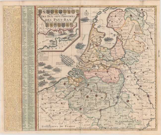
Subject: Low Countries

Period: 1708 (published)

Publication: Atlas Historique…

Color: Hand Color

Size:
22.4 x 18.4 inches
56.9 x 46.7 cm
Download High Resolution Image
(or just click on image to launch the Zoom viewer)

Fascinating chart of the Low Countries depicting the various battles, both land and sea, between the late 1500's to the early 1700's. All the major fortified cities are graphically depicted with notations of battle dates. Large inset of the English Channel features more sea battles and the cartouche containing the arms of the provinces. A splendid chart providing a synopsis of history.

References:

Condition: A

A crisp impression, issued folding and now flattened, with a tiny hole at a fold intersection and a hint of toning along the centerfold.

Estimate: $300 - $400

Unsold

Closed on 9/13/2017

Archived