Catalog Archive
Auction 164, Lot 486

"[On 2 Sheets] Irlandiae Regnum", Mercator/Hondius
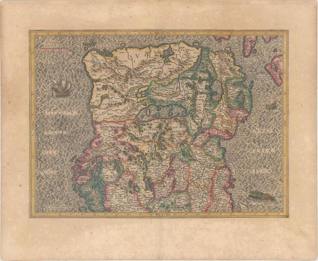
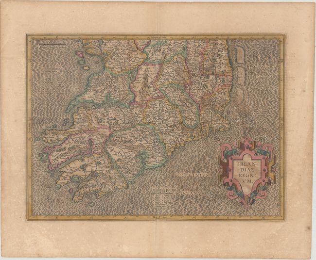
Subject: Ireland

Period: 1619 (published)

Publication: Gerardi Mercatoris - Atlas sive Cosmographicae…

Color: Hand Color

Size:
18.5 x 13.4 inches
47 x 34 cm
Download High Resolution Image
(or just click on image to launch the Zoom viewer)

Superb early pair of maps covering the whole of Ireland compiled from his landmark map of Britain (1564). These two maps were among five Irish maps Mercator designed for the second part of his Atlas. The maps are richly engraved with a moiré pattern in the seas and strong topographical features in the interior. The northern section is decorated with sailing ships and a sea monster and there is no title cartouche - only Mercator's imprint. The southern sheet features the bold, strapwork title cartouche. Size is for each map. French text on verso.

References: Law, pp. 19-20; Van der Krogt (Vol. I) #5901:1.1 & #5902:1.1.

Condition: B

Full original color on watermarked paper with moderate toning and offsetting.

Estimate: $700 - $850

Unsold

Closed on 9/13/2017

Archived