Catalog Archive
Auction 164, Lot 466

"Britannicarum Insularum Typus", Ortelius, Abraham
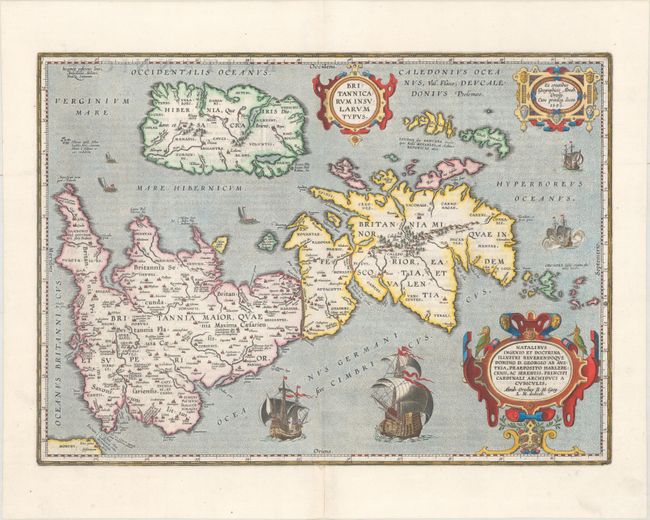
Subject: Britain

Period: 1624 (published)

Publication: Theatri Orbis Terrarum Parergon

Color: Hand Color

Size:
19.9 x 14.3 inches
50.5 x 36.3 cm
Download High Resolution Image
(or just click on image to launch the Zoom viewer)

This handsome map of Roman Britain is based on information from Mercator's 1564 map of the British Isles, a new outline from Saxton's 1579 map, and ancient knowledge from Diodorus, Siculus, Plinius, Appianus, Tacitus, Caesar, and Strabo. The map is filled with ancient place names, and Hadrian's Wall and Wall of Pius (mislabeled Severi Imp. Murus) are located. Richly embellished with three large strapwork cartouches and several sailing vessels. Engraved by Jan Wierix. Latin text on verso.

References: Shirley (BI to 1650) #186, plt. 42; Van den Broecke #192.

Condition: A

A sharp impression on a clean, bright sheet with professional repairs to centerfold separations confined to the top and bottom blank margins.

Estimate: $1,000 - $1,300

Unsold

Closed on 9/13/2017

Archived