Catalog Archive
Auction 164, Lot 444

"Canarische Eylanden Canaria, Tenerisa, Forteventura Etc.", Doncker, Henrick

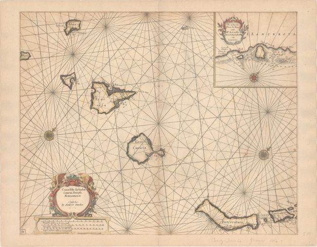
Subject: Canary Islands

Period: 1659 (circa)

Publication: De Zee-Atlas ofte Water-Waerelt

Color: Hand Color

Size:
21 x 16.8 inches
53.3 x 42.7 cm
Download High Resolution Image
(or just click on image to launch the Zoom viewer)

This attractive sea chart depicts the Canary Islands with north oriented to the top right corner of the sheet. At inset at top right show finer detail of Lanzarote Island from Porto de Cavallos to Porto de Naos. The chart includes a few place names on the islands as well as numerous soundings, shoals and anchorages. The decorative title cartouche at lower left is surmounted by two putti.

References:

Condition: B

Trimmed to the neatline all around and entirely backed with old paper. There is a thin, 3" abrasion to the right of the centerfold with a minor amount of rhumb lines drawn in facsimile and light scattered foxing.

Estimate: $350 - $425

Unsold

Closed on 9/13/2017

Archived