Catalog Archive
Auction 164, Lot 439

"Exquisita & Magno Aliquot Mensium Periculo Lustrata Etiam Retecta Freti Magellanici Facies...", Mercator/Hondius

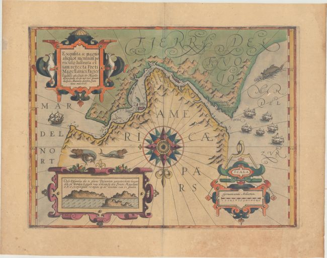
Subject: Strait of Magellan

Period: 1609 (published)

Publication: Gerardi Mercatoris - Atlas sive Cosmographicae

Color: Hand Color

Size:
18.1 x 13.6 inches
46 x 34.5 cm
Download High Resolution Image
(or just click on image to launch the Zoom viewer)

This exquisite map of the Strait of Magellan predates the discovery of the Straits of Le Maire. It details soundings and navigational hazards in this strategic waterway. The geographic details for this map were drawn from Bernardus Joannis Monasteriensis who accompanied the first Dutch expedition to sail through the Strait in 1599-1600. That expedition is portrayed on the map by the fleet of six sailing ships in the Mar del Zur. The map is one of the most beautifully embellished maps of the Mercator atlas. It is centered on an elaborate compass rose orienting the map with north at the bottom. There are three large strapwork cartouches: the title flanked by penguins, the distance scale with an incorporated compass, and an inset with coastal view of the entrance to the strait fills the last cartouche. Whimsical sea lions, a monstrous whale, and sailing ships complete the composition. French text on verso.

References: Van der Krogt (Vol. I) #9950:1A.

Condition: B

Full original color on watermarked paper with moderate toning and light soiling.

Estimate: $600 - $750

Sold for: $650

Closed on 9/13/2017

Archived