Catalog Archive
Auction 164, Lot 356

"[Lot of 2] Map of the Californias [and] Mexico", Morse & Breese

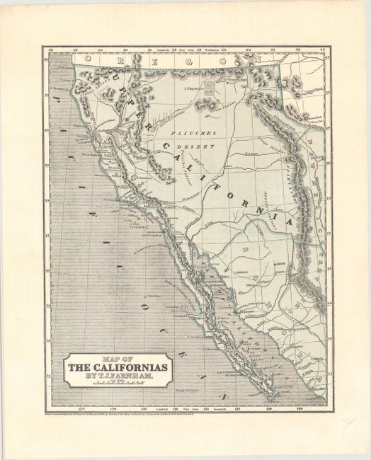
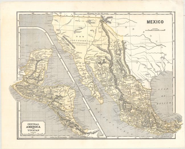
Subject: Western United States & Mexico

Period: 1845 (circa)

Publication: Morse's North American Atlas

Color: Hand Color

Size:
See Description
Download High Resolution Image
(or just click on image to launch the Zoom viewer)

This map was printed using the revolutionary cerographic process, a milestone in cartographic printing techniques. This early printed color technique was an important change in the way maps were produced and the only truly American cartographic publishing innovation.

A. Map of the Californias, by T.J. Farnham, dated 1845 (10.9 x 13.9"). This map shows Upper California just one year prior to the Mexican-American war, which resulted in Mexico's loss of the region to the United States. It locates the pre-gold rush settlement of "Suter's" Colony just east of the southwest flowing Sacramento River with a Volcano nearby which is likely the Marysville Butte. Mount Shasta is here named Mt. Jackson with the Sierra Nevada mountains located between it and the coast. Farnham details an emigrant route that travels up the Arkiansas River to Farnham's Pass then across the country of Brown's Hole, to the Bear River, around the north shore of L. Timpanigos (Great Salt Lake), eventually to the upper San Joaquin and on to the bay at Yerba Buena, today's San Francisco. The map was drawn by Thomas J. Farnham, author of Travels in the Californias, based on his talks with the trapper Ewing Young and a letter from Dr. John H. Lyman of Buffalo, N.Y., who had earlier traveled on the Old Spanish Trail from Santa Fe to Los Angeles. Of special interest are the small icons locating the twenty-one missions of Upper California.

B. Mexico (16.3 x 11.9"). California and the western states are controlled by Mexico and shown as New California. Texas is Independent and the settlements of Austin, Nacogdoches, and S. Antonio de Bexar are located. This pre-Fremont map shows a large swamp in the area of today's Great Basin with rivers flowing across its expanse. The Great Salt Lake is here named L. Youia (salt) with the American Fur Depot on its eastern shore. With a large inset map "Central America and Yucatan." Wheat notes that this is the same map as published by the company in 1842.

References: Wheat (Gold) #20; Wheat (TMW) #494 & #469; Phillips (A) #1228-34 & #1228-35.

Condition: A

Dark impressions on clean sheets.

Estimate: $400 - $500

Sold for: $300

Closed on 9/13/2017

Archived