Catalog Archive
Auction 164, Lot 268

NO RESERVE

"[Lot of 3] (G No. 4) Preliminary Chart of St. Andrew's Bay Florida from a Trigonometrical Survey... [and] Ocilla River Florida by the Hydrographic Party... [and] Preliminary Survey of Turtle Harbor Florida Reefs...", U.S. Coast Survey

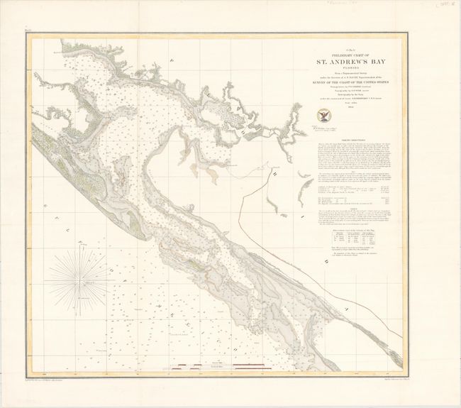
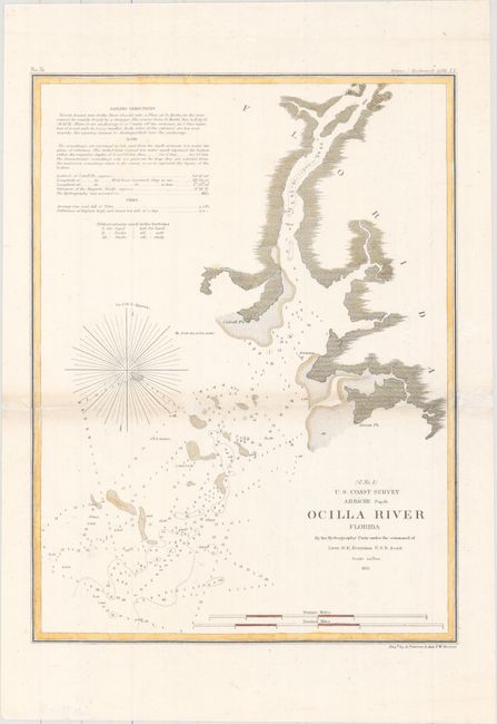
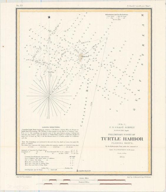
Subject: Northwestern Florida

Period: 1854-55 (dated)

Publication:

Color: Hand Color

Size:
See Description
Download High Resolution Image
(or just click on image to launch the Zoom viewer)

The Office of Coast Survey is the oldest U.S. scientific organization, dating from 1807 when Congress directed that a "survey of the coast" be carried out. By 1836, it was called the U.S. Coast Survey and in 1878, the name was changed to the U.S. Coast and Geodetic Survey. Today the Office of Coast Survey is a division of the National Oceanic and Atmospheric Administration NOAA.

The survey teams, composed of civilians as well as Army and Naval officers, charted the nation's waterways and produced a wide array of reports, survey charts, hydrographic studies of tides and currents, astronomical studies and observations, and coastal pilots. These charts are an important record of the changing nature of the nation's coastlines. In additional to coastal charts, the U.S. Coast and Geodetic Survey produced land sketches, Civil War battle maps, and the early aeronautical charts.

This lot includes three striking charts from the U.S. Coast Survey from the Big Bend of Florida. The first chart shows St. Andrew's Bay in intricate detail. The second chart covers the mouth of the Aucilla River (here Ocilla River), and the third chart zeros in on Turtle Harbor. Each includes soundings and other navigational information.

A. (G No. 4) Preliminary Chart of St. Andrew's Bay Florida from a Trigonometrical Survey..., dated 1855 (19.4 x 17.6").
B. Ocilla River Florida by the Hydrographic Party..., dated 1855 (9.3 x 12.3").
C. Preliminary Survey of Turtle Harbor Florida Reefs..., dated 1854 (7.8 x 9.5").

References:

Condition: B+

All three maps were issued folding and now flattened and backed with tissue to reinforce and repair several minor splits at fold intersections. There is minor toning along the fold of the <i>Ocilla River</i> map.

Estimate: $120 - $150

Sold for: $12

Closed on 9/13/2017

Archived