Catalog Archive
Auction 164, Lot 215

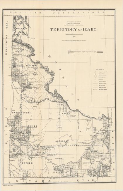
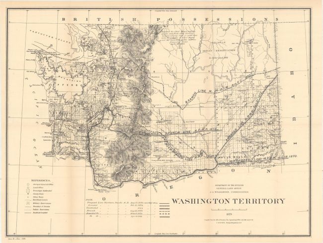
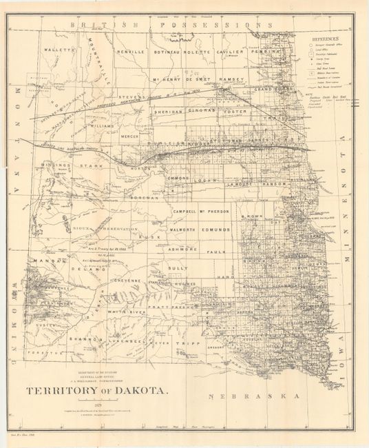
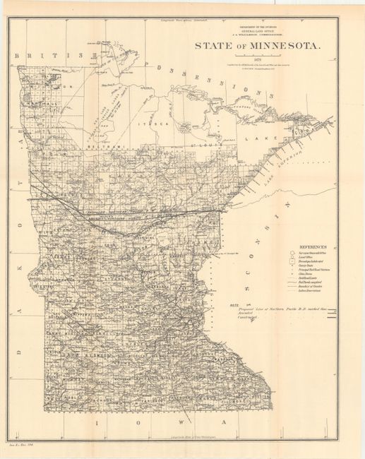
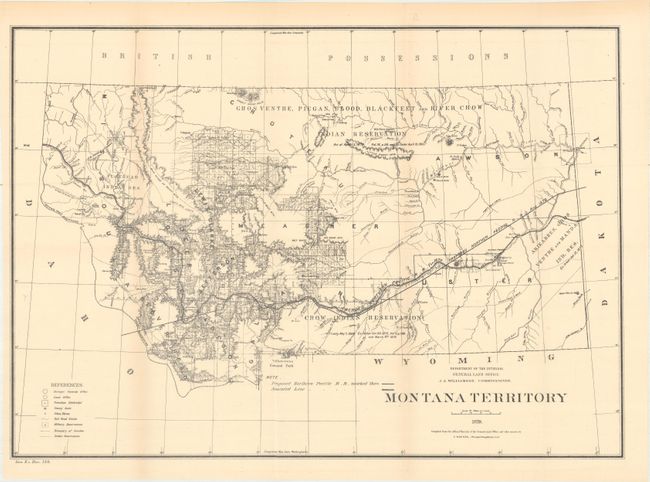
"[Lot of 5] Territory of Idaho [and] Washington Territory [and] Territory of Dakota [and] State of Minnesota [and] Montana Territory", General Land Office

Subject: Western United States

Period: 1879 (dated)

Publication: Sen. Ex. Doc. 120

Color: Black & White

Size:
See Description
Download High Resolution Image
(or just click on image to launch the Zoom viewer)

This lot of 5 maps shows the proposed course of the Northern Pacific Railroad from Lake Superior to Washington Territory with amendments as of 1879. In addition to the railroad detail, the map locates land offices, townships, cities, towns and military reservations. The map of Washington Territory includes an interesting note stating that the northern portion of the territory was “Reserved for Chief Moses and his people, and such other friendly Indians as may elect to settle here with the consent of, Chief Moses and the Secretary of the Interior.” Drawn by C. Roeser, Principal Draughtsman.

A. Territory of Idaho, (13.8 x 20.9").
B. Washington Territory, (21.1 x 15.9").
C. Territory of Dakota, (17.6 x 21.0").
D. State of Minnesota, (16.7 x 21.1").
E. Montana Territory, (21.1 x 14.9").

References:

Condition: B+

Issued folding with pleasant light toning. The map of Dakota Territory has a binder's cut at left that is trimmed to the neatline.

Estimate: $200 - $250

Sold for: $200

Closed on 9/13/2017

Archived