Catalog Archive
Auction 164, Lot 179
"Carte des Costes de la Floride Francoise Suivant les Premieres Decouvertes", Bellin, Jacques Nicolas
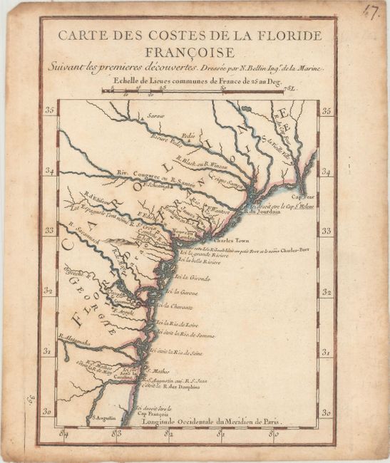
Subject: Colonial Southeast United States
Period: 1744 (circa)
Publication: Charlevoix's Histoire et Description de la Nouvelle France
Color: Hand Color
Size:
5.8 x 8.2 inches
14.7 x 20.8 cm
Download High Resolution Image
(or just click on image to launch the Zoom viewer)
(or just click on image to launch the Zoom viewer)