Catalog Archive
Auction 164, Lot 166

"Rhode-Island and Connecticut", Morse, Jedidiah (Rev.)

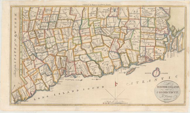
Subject: Connecticut & Rhode Island

Period: 1796 (circa)

Publication: The American Universal Geography

Color: Hand Color

Size:
13.3 x 7.6 inches
33.8 x 19.3 cm
Download High Resolution Image
(or just click on image to launch the Zoom viewer)

This early map of Rhode Island and Connecticut was published in Morse’s The American Universal Geography. The map depicts counties, townships, rivers and numerous small lakes and ponds. In the west the Oblong is shown, which was a 2 by 50 mile stretch of land given to New York in return for Connecticut’s boundary extending westward along Long Island Sound. Drawn by Harding Harris and engraved by Samuel Hill.

References: McCorkle (18th C. Geography Books) #304-6; Wheat & Brun #287.

Condition: B+

Issued folding, now flattened with archival repairs to a few small chips and tears along the edges of the sheet, with several of the repaired tears entering less than 1/2" into the image.

Estimate: $180 - $210

Sold for: $90

Closed on 9/13/2017

Archived