Catalog Archive
Auction 164, Lot 122

Second Edition of Greenleaf's Large Map of Maine

"[Wall Map] Map of the State of Maine with the Province of New Brunswick", Greenleaf, Moses

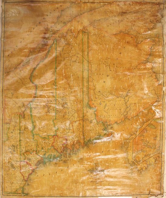
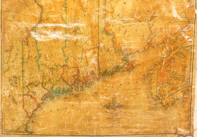
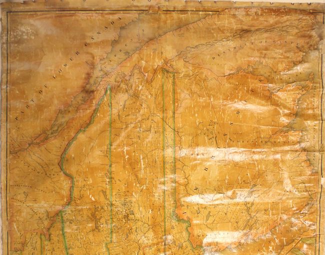
Subject: Maine, Eastern Canada

Period: 1832 (dated)

Publication:

Color: Hand Color

Size:
41 x 49.2 inches
104.1 x 125 cm
Download High Resolution Image
(or just click on image to launch the Zoom viewer)

This is the second edition of Greenleaf's important, enlarged map of the state, first appearing in 1829. Highly detailed, it delineates ten counties including the very large Somerset, Penobscot, and Washington counties. Much of the state has been surveyed to this point, with numerous named land grants as well as a few Indian townships. The northern and southern boundary of Bingham's Purchase is identified. The map provides good detail of the state's numerous rivers, lakes, ponds, roads and topography. While the map was published in Portland, Maine by Shirley & Hyde, the engraving was executed by J.H. Young and F. Dankworth in Philadelphia. A more common third edition of this map was published in 1844 by Greenleaf's son using the same plate with the addition of new towns, counties, and the newly established border with Canada.

Moses Greenleaf first issued maps of Maine in 1815 and 1820, but neither was nearly as detailed or complete as the enlarged versions beginning in 1829. Upon seeing some of Greenleaf's early plans and sketches, the state legislature granted him $1000 in 1828 "to assist him in completing and publishing his series of Maps and Statistical View of the State" (Ristow).

References: cf. Phillips (Maps) p. 384; cf. Ristow pp. 94-96.

Condition: B

There are numerous abrasions and cracks to the original varnish as is typical for wall maps of this period. There are also some chips and fraying along the sheet edges with minor image loss in the top right corner. The original rollers are present, but detached.

Estimate: $1,400 - $1,700

Sold for: $950

Closed on 9/13/2017

Archived