Catalog Archive
Auction 164, Lot 117

"A Map of the Northern and Middle States; Comprehending the Western Territory and the British Dominions in North America. From the Best Authorities", Stockdale, John

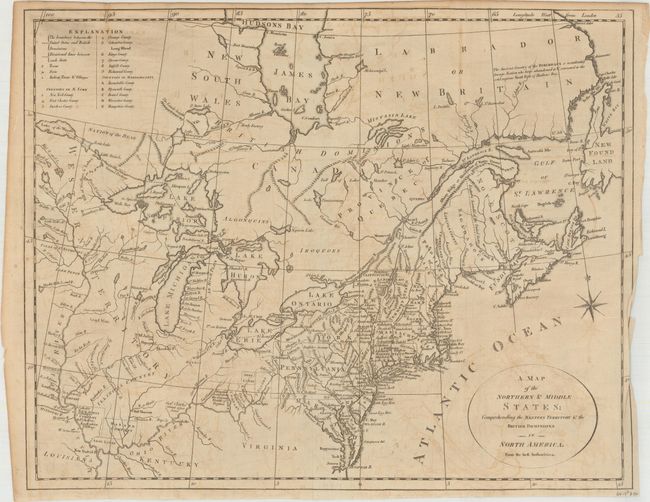
Subject: Eastern United States & Canada

Period: 1792 (circa)

Publication: Morse's Geography

Color: Black & White

Size:
15.7 x 12.5 inches
39.9 x 31.8 cm
Download High Resolution Image
(or just click on image to launch the Zoom viewer)

This uncommon and information-packed map describes the region from James Bay to Chesapeake Bay and the confluence of the Mississippi and Ohio Rivers, and from the Lake of the Woods to the Gulf of St. Lawrence. An explanation of the various symbols used in the map is displayed in the form of an open book in the upper left corner. Several of the districts and states are shown with distorted borders, but the most interesting feature of the map are the numerous Bounty Land Grants shown in the western frontier including Genl Clarks, Donation Lands from the Commonwealth of Virginia, and Ohio Company in Ohio, and Wabash Company, New Jersey Company, and Illinois Company in Illinois. This is the first state, with information taken from Amos Doolittle's map of the same title. Engraved by G. Allen Sanders, Wells Row, Islington.

References: McCorkle #792.1; Kershaw #388.

Condition: B+

Issued folding on watermarked paper with light offsetting and a short fold separation that extends 0.5" into the image at right that has been closed on verso with archival tape.

Estimate: $500 - $650

Sold for: $150

Closed on 9/13/2017

Archived