Catalog Archive
Auction 164, Lot 112

"A Map of the British Empire, in North America", Dunn, Samuel

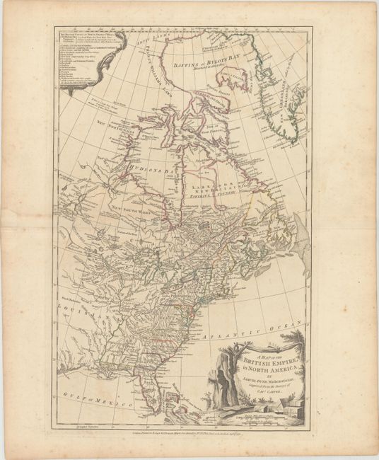
Subject: Colonial Eastern United States & Canada

Period: 1776 (dated)

Publication:

Color: Hand Color

Size:
12.1 x 18.8 inches
30.7 x 47.8 cm
Download High Resolution Image
(or just click on image to launch the Zoom viewer)

This uncommon map is based on the surveys of Captain Jonathan Carver and was issued during the Revolutionary War period. This particular map was issued in both The American Military Pocket Atlas, also known as the Holster Atlas carried by British redcoats, and Thomas Jeffrey's American Atlas. The western boundaries of most of the thirteen colonies are left open, but the colonial claims extend to the Mississippi River. A key at the upper left lists the British territories claimed in North America, including the Hudson Bay Company lands, the Reserved Lands west of Appalachia to the Ohio and Mississippi rivers, in addition to both East and West Florida. A notation west of Hudson Bay notes that if there is a Northwest Passage, it would be through one of the inlets attached to Hudson Bay. The decorative landscape cartouche depicts the boxes of tea from the Boston Tea Party of 1773 as well as the paddles the Bostonians used to push any recalcitrant floating boxes back into the sea. This is the second state of the map with the addition of "Improved from the Surveys of Capt. Carver" in the title cartouche.

References: McCorkle #776.9; Sellers & Van Ee #129; Phillips (Maps) p. 586; Schwartz & Ehrenberg p. 190.

Condition: B+

On watermarked paper with light scattered foxing and a repaired short fold separation confined to the left blank margin.

Estimate: $1,100 - $1,400

Unsold

Closed on 9/13/2017

Archived