Catalog Archive
Auction 163, Lot 96

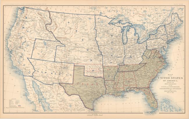
"Map of the United States of America, Showing the Boundaries of the Union and Confederate Geographical Divisions and Departments, Dec. 31, 1861", U.S. War Department

Subject: United States

Period: 1891-95 (published)

Publication: Atlas to Accompany the Official Records of the Union and Confederate Armies...

Color: Printed Color

Size:
27.8 x 16.9 inches
70.6 x 42.9 cm
Download High Resolution Image
(or just click on image to launch the Zoom viewer)

This interesting Civil War sheet comes from the government's comprehensive atlas covering the War Between the States. This plate was issued between 1891 and 1895 to accompany the Official Army Records and was published under the Secretaries of War Redfield Proctor, Stephen B. Elkins, and Daniel S. Lamont by Maj. Gen. George B. Davis, assisted by civilian experts Leslie Perry and Joseph Kirkley. The sheet comes from a series of ten maps tracking changes in boundaries, the position of troops, and the status of Confederate states in six month intervals throughout the course of the war. This is the sheet depicting the nation as it was on December 31, 1861. Changes from the previous map in the series, dated June 30, 1861, include sectioning off part of Virginia and Maryland as the Union-controlled Potomac, shrinking the Ohio deparment, and splitting the area previously named West between Missouri and Kansas departments.

References:

Condition: A

There is light toning along the sheet edges.

Estimate: $120 - $150

Sold for: $90

Closed on 6/14/2017

Archived