Catalog Archive
Auction 163, Lot 76

"Map of the United States to Illustrate Olney's School Geography", Robinson, D.F. & Co.

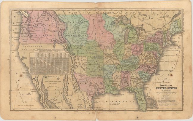
Subject: United States, Texas

Period: 1828 (dated)

Publication: Olney's School Geography

Color: Hand Color

Size:
17.4 x 10.3 inches
44.2 x 26.2 cm
Download High Resolution Image
(or just click on image to launch the Zoom viewer)

Great map of the United states that features the Independent Republic of Texas. The northern portion of Upper California is marked Unexplored Region, with much of the Southwest covered by a table of distances. The huge Oregon Territory extends to the Continental Divide and well north into British America. East of Oregon is a large Missouri Territory that extends to an oversized Iowa at the Missouri River, that in turn extends to Wisconsin at the Mississippi River. Texas extends to about 35° with a small New Mexico to the west. The map has terrific territorial configurations and is filled with information on forts, Indian tribes, waterways, and more. Copyright date of 1828 by D.R. Robinson, but published circa 1840.

References:

Condition: B

Original color with light toning, soiling, and offsetting. There are short centerfold separations at top and bottom.

Estimate: $140 - $170

Sold for: $220

Closed on 6/14/2017

Archived