Catalog Archive
Auction 163, Lot 73

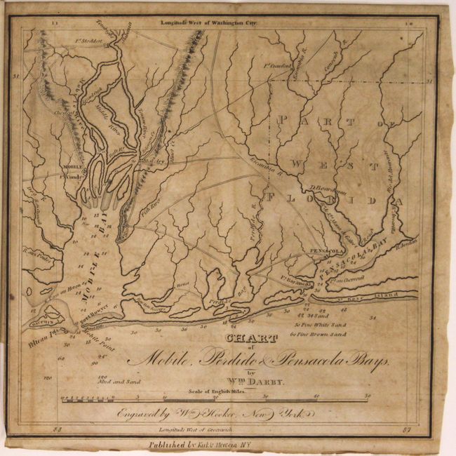
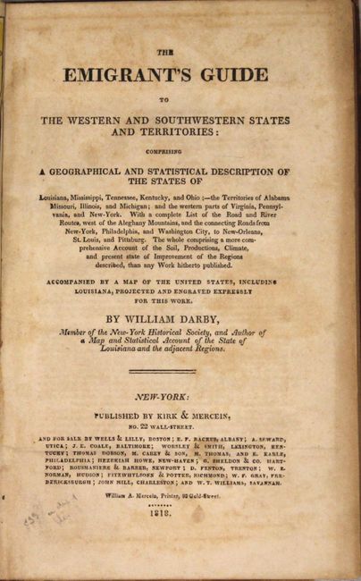
Darby's Early Emigrant Guide

"A Map of the United States Including Louisiana [in] The Emigrant's Guide to the Western and Southwestern States and Territories...", Darby, William

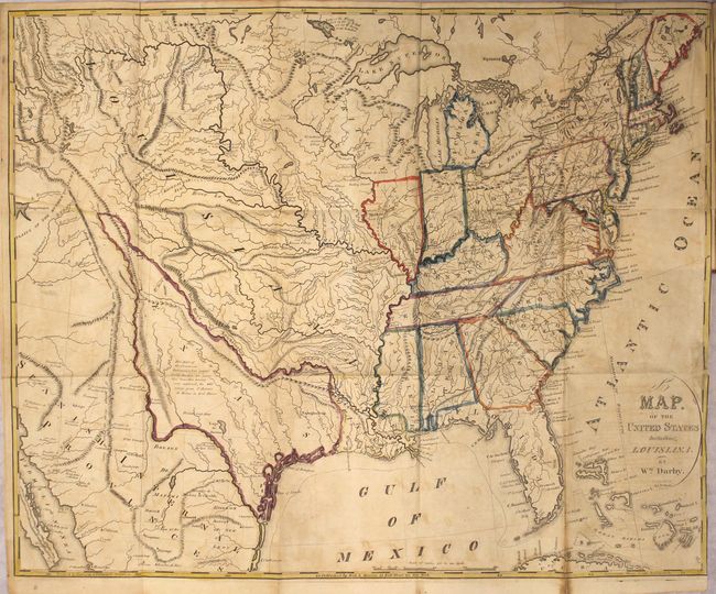
Subject: United States

Period: 1818 (published)

Publication:

Color: Hand Color

Size:
5.5 x 8.7 inches
14 x 22.1 cm
Download High Resolution Image
(or just click on image to launch the Zoom viewer)

This rare, important guide is packed with useful information for travelers. Bound into the front of the volume is a large, folding Map of the United States Including Louisiana (22.5 x 18"). The map features an unusual, early "stovepipe" configuration of Texas with a narrow panhandle trailing northwesterly into the Rocky Mountain region. A note located in the interior portion of Texas states that "this part of the Provincias Internas is but imperfectly known; no scientific traveller having ever explored, the wide range from St. Antonio de Behar to Red River." Louisiana is shown with its current boundaries for the state and also in its large territorial configuration. The Missouri Territory is named, but not delineated. Also included is a small folding map entitled Chart of Mobile, Perdido & Pensacola Bays (8 x 8"), and an untitled single-page diagram of a township & range survey system. Sabin notes two maps, while Howes calls for three (the diagram being the likely difference). 311 pages plus a 13 page index. Octavo, hardbound in original, full leather with gilt title on spine.

References: Howes #D61; Wheat (TMW) #326; Sabin #18527.

Condition: B+

The folding map has original outline color with light toning and offsetting, minor repaired fold separations, and a 6" binding tear at right that also has been repaired on verso with archival material. Text has light toning and scattered foxing, and the small folding map of Pensacola has moderate toning. Light shelf wear.

Estimate: $2,000 - $2,300

Sold for: $1,700

Closed on 6/14/2017

Archived