Catalog Archive
Auction 163, Lot 67

"Carte Generale des Etats-Unis, des Haut et Bas-Canada, de la Nouvle. Ecosse, du Nouvau. Brunswick, de Terre-Neuve, &a. Seconde Edition", Brue, Adrien Hubert

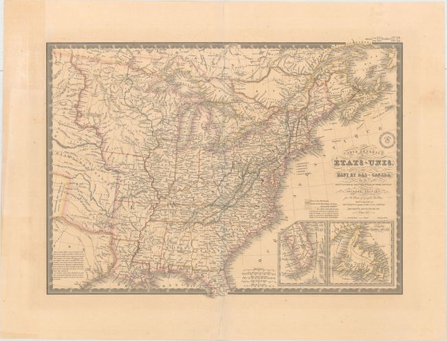
Subject: Eastern United States & Canada

Period: 1840 (dated)

Publication: Atlas Universel de Geographie...

Color: Hand Color

Size:
20.3 x 14.8 inches
51.6 x 37.6 cm
Download High Resolution Image
(or just click on image to launch the Zoom viewer)

An uncommon and finely engraved map covering all the eastern United States to about the 100th meridian, with a portion of southern Canada. The northwestern territories include a large Iowa Territory and Ter. Du Nord Ouest that encompasses present-day Wisconsin, the Upper Peninsula of Michigan, and eastern Minnesota. The rest of the West past Missouri and Arkansas is designated as Indian Districts/i>. The eastern half of the Republic of Texas is shown but is mostly blank with a lengthy notation filling the central portion. Insets of the tip of Florida and Newfoundland are located in the lower right. Surrounded by a decorative keyboard-style border that indicates longitude from Paris. The handsome map includes fancy title lettering embellished with flourishes and Brue's embossed seal.

References:

Condition: B+

Original color with light toning, minor extraneous creasing adjacent to the centerfold, and a short centerfold separation confined to the top blank margin.

Estimate: $180 - $220

Sold for: $130

Closed on 6/14/2017

Archived