Catalog Archive
Auction 163, Lot 52

Rare Map Showing the Territory of Deseret

"Die Vereinigten Staaten von Nord America nebst Canada", Weimar Geographisches Institut

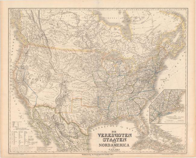
Subject: United States & Canada

Period: 1852 (dated)

Publication:

Color: Hand Color

Size:
25.1 x 20.5 inches
63.8 x 52.1 cm
Download High Resolution Image
(or just click on image to launch the Zoom viewer)

This rare, large and very detailed German map covers the United States with parts of Canada and Mexico, and depicts the Territory of Deseret. The area of Nevada and Utah is labeled Utah Deseret Territory, which was originally proposed by the Mormon leadership in 1849 but was never recognized by the US government. Indian Territory extends well into present-day Kansas, while a huge Nebraska Territory extends to the Canadian border, with Minisotah Territory to the east and Oregon Territory to the west. New Mexico Territory extends into Arizona, which is largely blank, and north into Colorado. The states and territories are shown with superb detail of railroads, rivers, topography, Indian tribes and emigrant roads. An inset at right depicts New England in greater detail. Drawn by H. Kiepert and engraved by C. J. Maedel. An rare map that is very finely engraved in the German style.

References:

Condition: B+

Original outline color with minor offsetting, a few small spots, and light toning along the edges of the sheet. There is a centerfold separation that just touches the neatline at bottom and a tear that enters 1" into the image in Hudson Bay that have both been archivally repaired on verso.

Estimate: $475 - $600

Sold for: $350

Closed on 6/14/2017

Archived