Catalog Archive
Auction 163, Lot 49

Includes the Reduced, First State of Lahontan's Influential Map Depicting <i>Riviere Longue</i>

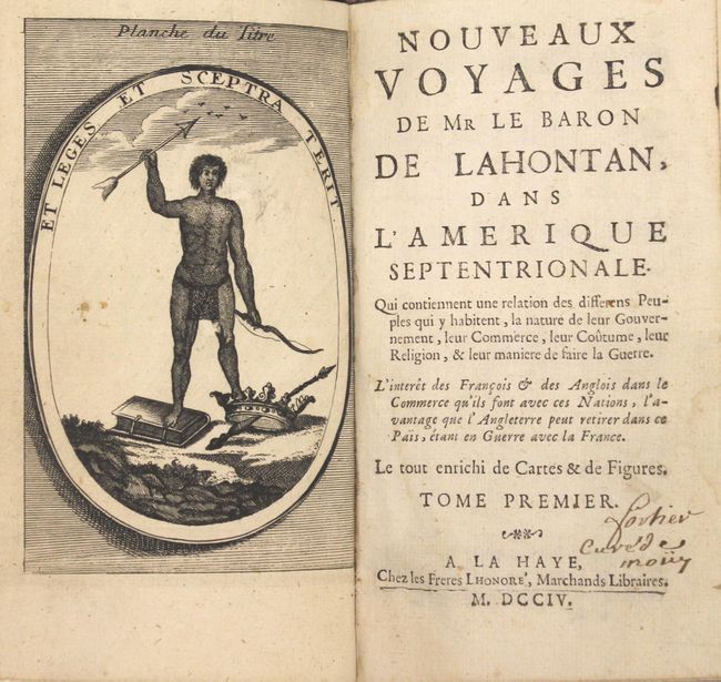
"[2 Volumes] Nouveaux Voyages de Mr Le Baron de Lahontan, dans l'Amerique Septentrionale... [and] Memoires de l'Amerique Septentrionale, ou la Suite des Voyages...", Lahontan, Louis Armand, Baron de

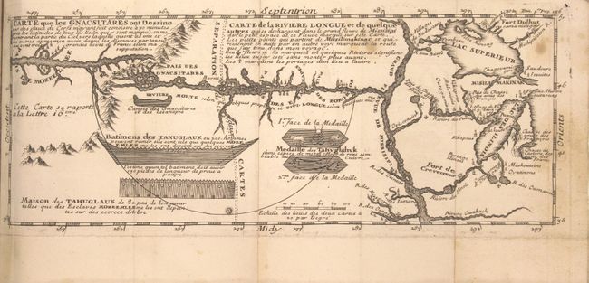
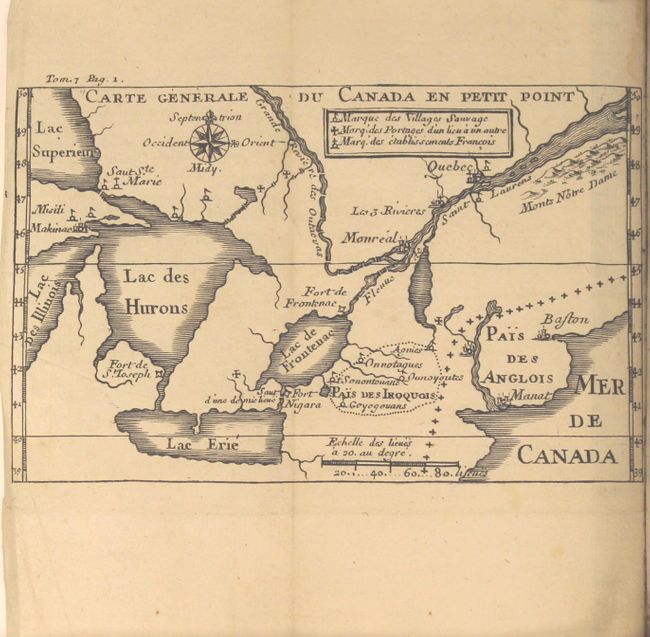
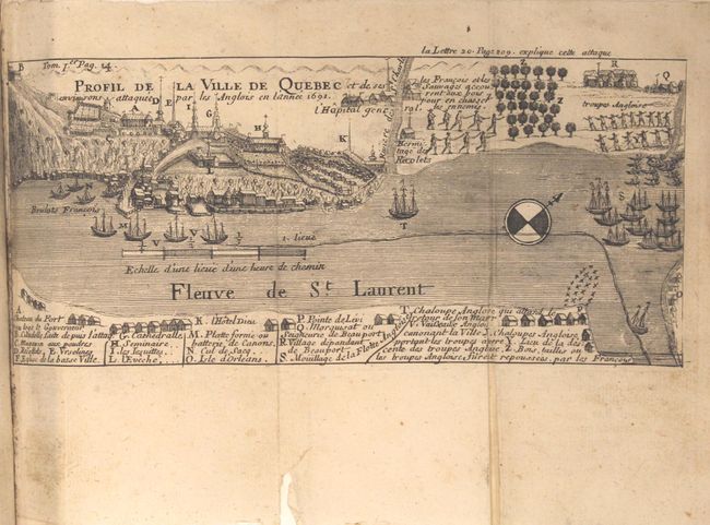
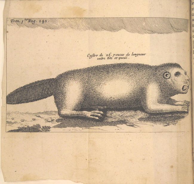
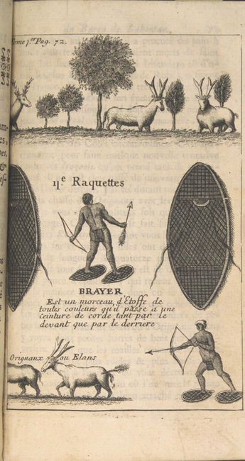
Subject: Colonial United States & Canada, Exploration, River Longue

Period: 1704-09 (published)

Publication:

Color: Black & White

Size:
4 x 6.9 inches
10.2 x 17.5 cm
Download High Resolution Image
(or just click on image to launch the Zoom viewer)

Louis Armand, Baron de Lahontan served ten years in the French military in Canada, was involved in the Indian Wars, and commanded several posts in the west. He traveled extensively in the Wisconsin and Minnesota region and the upper Mississippi Valley. Upon his return to Europe he wrote this enormously popular travelogue. In it he embellished his knowledge of the geography of the Great Lakes region, invented Indian tribes, and created several fictions, particularly the River Longue, which he claimed extended from the Mississippi River to the Rocky Mountains. Over twenty editions of his book were published between 1703 and 1741, including editions in French, English, Dutch and German. The immense popularity of the book resulted in his distorted cartography being accepted by several eminent cartographers who incorporated the "Lahontan" concepts into most 18th century maps.

Volume 1 is the 1704 French edition containing three folding maps and 11 single page plates of illustrations. Carte Generale du Canada en Petit Point (3.5 x 5.5") shows the Great Lakes, Boston, Manhattan (Manat) and the Saint Lawrence. It locates the lands of the Iroquois, Fort Niagara, Fort de S. Joseph, Sault Ste. Marie, Montreal and Quebec. Profil de la Ville de Quebec (8 x 3.6") is a bird's-eye view of Quebec with an extensive key below locating important buildings. The river is filled with French ships and the fleet of the British slightly down river. The third map is one of the most influential, and fanciful maps in American cartographic history, entitled Carte que les Gnacsitares ont Dessine sur…/ Carte de la Riviere Longue et de Quelques Autres… (11.5 x 5"). It purports to show the Riviere Longue flowing from the mountains in the west, home to the Gnacsitares Indians, and connecting to the Mississippi River. On the western side of the mountains is another river, presumably flowing into the Pacific. Lahontan's concept was copied by virtually all 18th century cartographers including Moll, Senex, Popple, and Delisle, thus perpetuating the myth. The map also includes balloon-shaped Lakes Superior and Michigan. This is the rare first state with "Tom 1er Pag. 136" at upper right. This first state has several differences with later maps including Mississippi written as Missisippi. Complete with 14 engravings and maps, 280 pp. Bound in original full brown calf, spine tooled in gilt with raised bands.

Volume 2 is the 1709 French edition of this important book. It includes 10 single-page illustrations and the Petit Dictionaire de la Langue des Sauvages, a very early Algonquin and Huron dictionary. No maps are present in this volume. 210 pages with a 17 page index. Also bound in original full brown calf, spine tooled in gilt with raised bands.

References: Howes #L25; Kershaw #283 & #299; McCorkle #703.4.

Condition: B+

The maps, plates, and text are generally clean and bright. <i>Carte que les Gnacsitares</i> has a few spots of foxing at right, and both this map and the Profile of Quebec has minor soiling. Volume one has light wear with minor abrasions on the covers and mild cracking of the spine. Volume two has moderate wear to covers and spine with a chip to the rear board.

Estimate: $1,400 - $1,700

Sold for: $1,600

Closed on 6/14/2017

Archived