Catalog Archive
Auction 163, Lot 48

Lay's Update to Samuel Holland's Map

"A New Correct Map of the Seat of War in Lower Canada Protracted from Hollands Large Map Compiled from Actual Survey Made by Order of the Provincial Government...", Lay, Amos

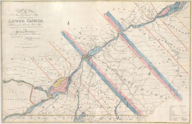
Subject: Eastern Canada, Quebec

Period: 1814 (circa)

Publication:

Color: Hand Color

Size:
33.1 x 21.6 inches
84.1 x 54.9 cm
Download High Resolution Image
(or just click on image to launch the Zoom viewer)

This separately issued map is based upon Samuel Holland's earlier map of the region with "many late additions and improvements." It presents the area from the Canadian/New York border near Massena northeast along the St. Lawrence River to Montreal and Quebec City. The map is divided into the districts of Montreal, Three Rivers, and Quebec with a key identifying court houses, churches, mills, iron works, roads, and lines of old French grants. The Battle of Crysler's Farm is noted in the lower left portion of the map, which was a significant victory for British/Canadian forces during the War of 1812, and caused the United States to abandon their St. Lawrence Campaign. Engraved by H.S. Tanner and published by Lay & Webster in Philadelphia.

References: Phillips (Maps) p. 195.

Condition: B

Issued folding and now flattened and professionally backed with heavy tissue to repair numerous fold separations, a 10" tear at right, and 4" tears at left and right. There is a small repaired chip along the left border with the "i" in District in facsimile. Trimmed close on all sides, but still adequate for framing.

Estimate: $1,600 - $2,000

Unsold

Closed on 6/14/2017

Archived