Catalog Archive
Auction 163, Lot 43

"Skeleton Map Showing the Rail Roads Completed and in Progress in the United States and Their Connection as Proposed with the Harbor of Pensacola...", U.S. Government

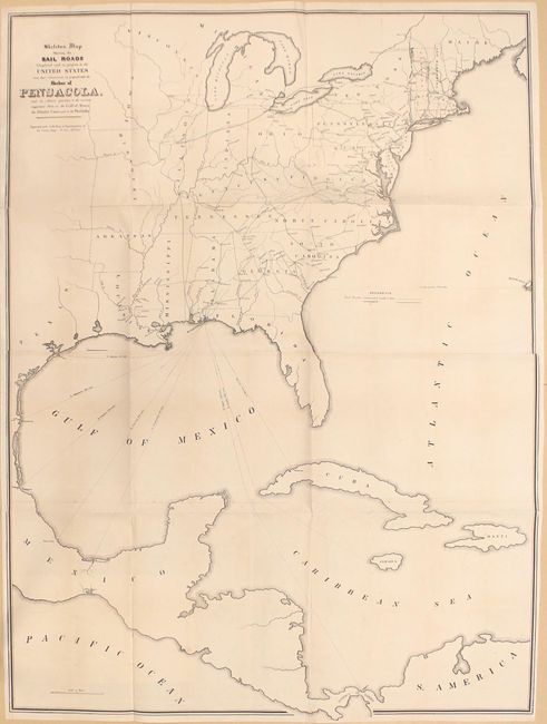
Subject: Eastern North America & West Indies

Period: 1847-48 (published)

Publication: 30th Congress, 1st Session

Color: Hand Color

Size:
36.1 x 48.9 inches
91.7 x 124.2 cm
Download High Resolution Image
(or just click on image to launch the Zoom viewer)

According to Modelski, this large, government-issued map was "one of the earliest small-scale government maps to show a railroad network." It covers the eastern United States, eastern Mexico, Central America, and the Greater Antilles and depicts both completed and proposed railroads within the United States. In addition to railroads, shipping routes radiate from Pensacola to various destinations including Galveston, Vera Cruz, Chagres and Havana demonstrating its favorable position to important ports. Printed on two sheets and joined.

References: Modelski (United States) #11.

Condition: B

Issued folding and backed with tissue to reinforce and repair numerous small fold separations and a 2" binding tear at left. Trimmed to border at left and lower right. Faint offsetting.

Estimate: $220 - $250

Unsold

Closed on 6/14/2017

Archived