Catalog Archive
Auction 163, Lot 419

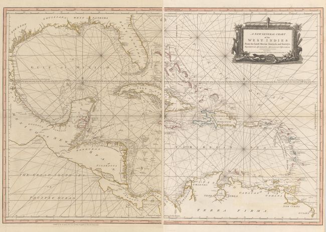
Detailed Chart of the Gulf of Mexico Showing Colonial Possessions

"[On 2 Sheets] A New General Chart of the West Indies from the Latest Marine Journals and Surveys, Regulated and Ascertained by Astronomical Observations", Sayer, Robert
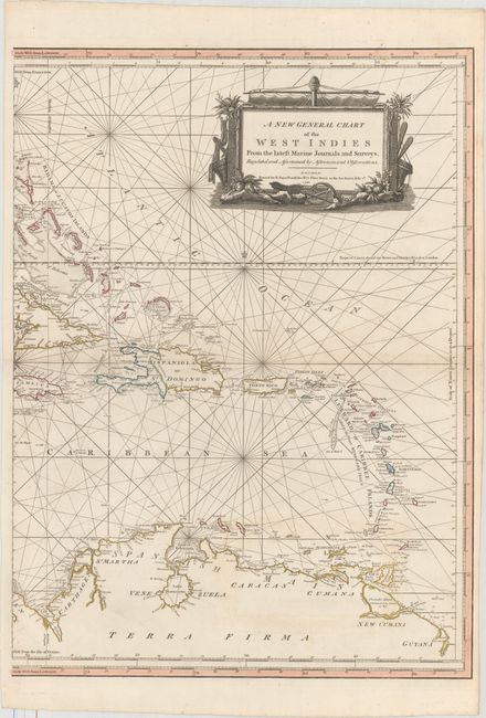
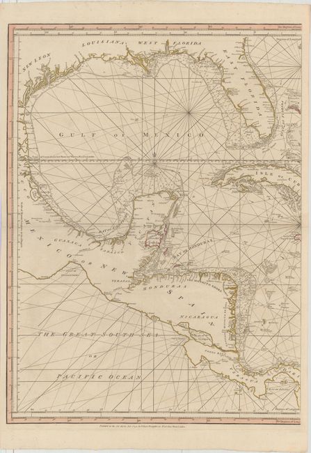
Subject: Gulf of Mexico & Caribbean

Period: 1790 (dated)

Publication:

Color: Hand Color

Size:
20.1 x 27.4 inches
51.1 x 69.6 cm
Download High Resolution Image
(or just click on image to launch the Zoom viewer)

A spectacular, large-scale chart of the Gulf of Mexico, Florida and the Caribbean printed on two separate sheets (dimensions given as if joined). The map is extremely detailed, and filled with information on coastal features, soundings, shoals and hazards. It extends to Central America and the northern tip of South America. The area now known as Belize is delineated as British Logwood Cutters, referring to the logwood, greatly valued in Europe as the principal dyestuff for the expanding wool industry. By the 1770s, mahogany replaced logwood as the main export from Belize. The colonial possessions are denoted in color: pink for the British, yellow for the Spanish, and blue for the French. The title is surrounded with a well-engraved cartouche comprised of items relating to the trade in the region. An uncommon map.

References:

Condition: A

A superb impression on two strong sheets with large watermarks of fleur-de-lis coats of arms. There is very faint toning on the horizontal centerfold.

Estimate: $2,000 - $2,300

Unsold

Closed on 6/14/2017

Archived