Catalog Archive
Auction 163, Lot 380

The First Copperplate Map Devoted to North America

"Nueva Hispania Tabula Nova", Gastaldi, Giacomo

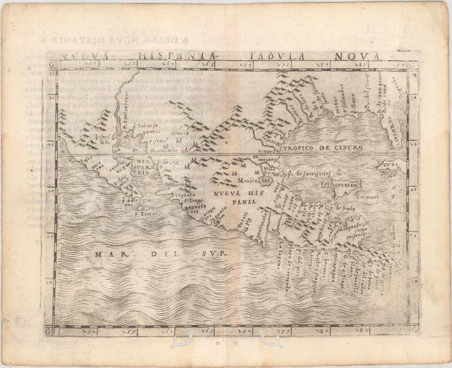
Subject: Southern United States & Mexico

Period: 1548 (circa)

Publication: Geografia di Claudio Ptolemo Alexandrino

Color: Black & White

Size:
6.8 x 5.1 inches
17.3 x 13 cm
Download High Resolution Image
(or just click on image to launch the Zoom viewer)

This map, along with Gastaldi's Tierra Nueva, was the first copperplate map devoted to North America. The transition from wood block to copper plate allowed for finer detail, which was important for Ptolemy's Geografia as it contained the first regional maps of the American continent and was the most comprehensive atlas published between Waldeemuller's Geographiae of 1513 and Abraham Ortelius' Theatrum of 1570. Cartographically, the map covers the region from Florida to Baja California and south to the Yucatan. Inland detail is confined to basic topography with a large R. tontonteanc representing either the Colorado or Gila River, and the Mississippi River is identified as the R. de Spirito Santo. This is the only issue of this map, but Girolamo Ruscelli enlarged it for his atlas in 1561.

References:

Condition: B+

Faint toning along the centerfold with a few worm tracks along the bottom border.

Estimate: $3,000 - $4,000

Sold for: $2,200

Closed on 6/14/2017

Archived