Catalog Archive
Auction 163, Lot 369

Rare and Important Maps That Helped Establish Independent Texas' Eastern Border

"[Lot of 3] A. 2. Part of the Boundary Between the United States and Texas... [and] B. 2. Part of the Boundary Between the United Statess and Texas... [and] C. 2. Part of the Boundary Between the United Statess and Texas...", U.S. Government

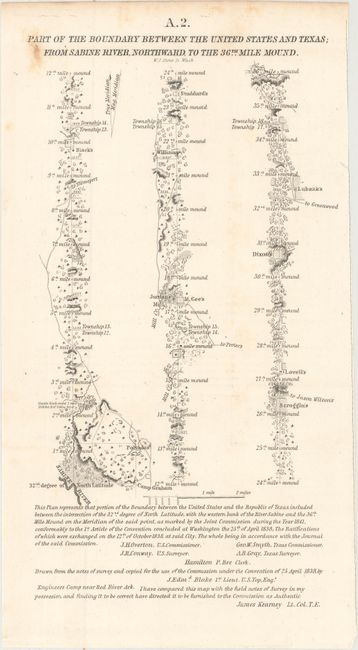
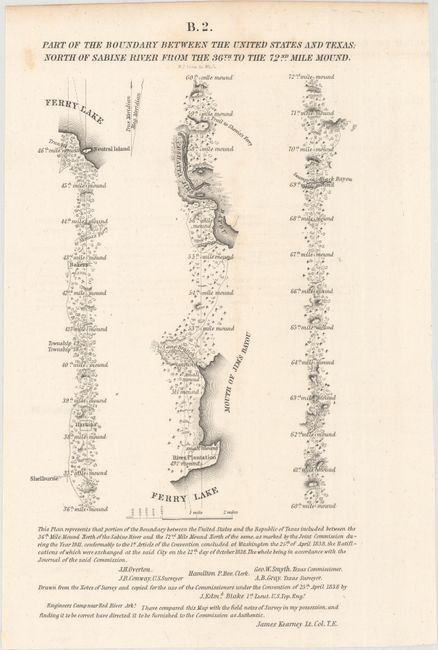
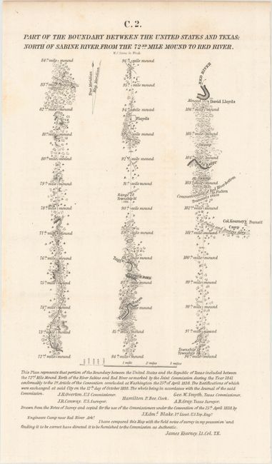
Subject: Texas-Louisiana Border

Period: 1842 (published)

Publication: Sen. Doc. 199, 27th Cong., 2nd Sess.

Color: Black & White

Size:
6 x 11.4 inches
15.2 x 29 cm
Download High Resolution Image
(or just click on image to launch the Zoom viewer)

This lot features three of the six maps issued with the report on the boundary survey between the Republic of Texas and the United States. The act admitting Louisiana to statehood in 1812 contained a clause defining its original boundaries. When Texas declared its independence in 1835, these borders came into question. This survey was made shortly thereafter. This report of the Joint United States-Texas Boundary Commission depicted the eastern border of Texas for the first time. These maps trace the boundary in strip-chart style. The first extends from the Sabine Rive north to the 36th Mile Mound, the second from the 36th to the 72nd Mile Mound, and the third from the 72nd Mile Mound to the Red River. These maps represent a rare and important part of Texas' cartographic history. Drawn by J. Edmund Blake and engraved by W.J. Stone.

References: Claussen & Friis #414-16; Day #952B-D; Martin & Martin p. 36.

Condition: B+

Issued folding with light scattered foxing at top near the titles.

Estimate: $275 - $350

Sold for: $200

Closed on 6/14/2017

Archived