Catalog Archive
Auction 163, Lot 346

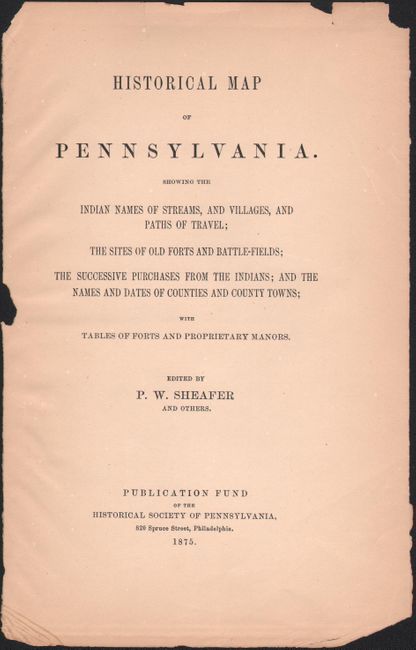
"An Historical Map of Pennsylvania Showing the Indian Names of Streams and Villages...", Sheafer, P. W.

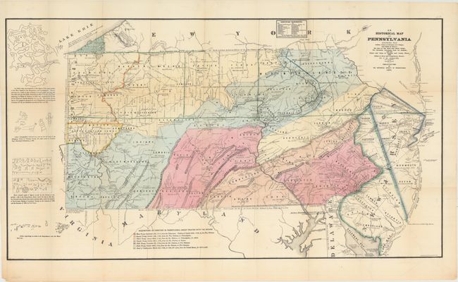
Subject: Pennsylvania

Period: 1875 (dated)

Publication:

Color: Hand Color

Size:
40.4 x 22.5 inches
102.6 x 57.2 cm
Download High Resolution Image
(or just click on image to launch the Zoom viewer)

This fascinating map is filled with information relating to Pennsylvania's development. The most prominent feature is the use of color to show the acquisition of Indian lands from 1718-1784. The map also locates numerous old forts and battlefields, Indian villages, and trails. To the left of the main image is a representation of an Indian map of the West Branch of the Susquehanna, hieroglyphics, and a series of carved figures. Included with the map is the title page from the report. Published by the Historical Society of Pennsylvania.

References: Phillips (Maps) p. 670.

Condition: B+

A clean, bright example with several small fold separations that have been closed on verso with archival tape. Issued folding and now flattened.

Estimate: $140 - $170

Sold for: $100

Closed on 6/14/2017

Archived