Catalog Archive
Auction 163, Lot 311

"Maine", Lucas, Fielding
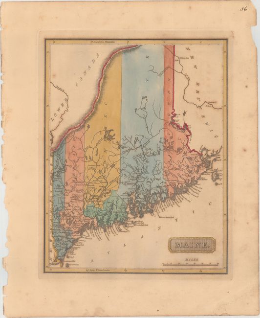
Subject: Maine

Period: 1816 (circa)

Publication: A New and Elegant General Atlas...

Color: Hand Color

Size:
8.4 x 10.6 inches
21.3 x 26.9 cm
Download High Resolution Image
(or just click on image to launch the Zoom viewer)

This uncommon map of Maine predates statehood. Despite a publication date of ca. 1816, county configuration is only current to 1799, with no Oxford County formed out of York and Cumberland. There are many towns identified in the southern part of the territory, but the northern part is left largely blank. Several bays, harbors, and small islands are identified along the coasts. The northernmost border is undefined. Drawn by Samuel Lewis and engraved by H.S. Tanner. Lucas' General Atlas is known as one of the finest general atlases produced in the U.S. at the time, due to the high quality paper, superior engraving quality, and attractive coloring style.

References: Phillips (Atlases) #3542-36.

Condition: B+

Full original color with light toning and a few spots of foxing. There is an edge tear that just enters the neatline at top right that has been closed on verso with archival tape, and a crease at bottom right that has been reinforced on verso with archival tape.

Estimate: $400 - $500

Sold for: $700

Closed on 6/14/2017

Archived