Catalog Archive
Auction 163, Lot 263

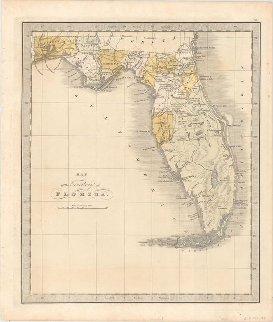
"Map of the Territory of Florida", Greenleaf, Jeremiah
Subject: Florida

Period: 1842 (circa)

Publication: A New Universal Atlas...

Color: Hand Color

Size:
10.8 x 12.6 inches
27.4 x 32 cm
Download High Resolution Image
(or just click on image to launch the Zoom viewer)

An uncommon map of Florida Territory that provides an early view of county development, primarily in the northern half of the state. County configurations are current to 1835, with only the large counties of Mosquito, Hillsborough, and Monroe depicted in the south. Dade County, which organized in 1836, is not shown. Seminole Country is shown in the central part of the state, surrounded by several forts in the vicinity. In the panhandle, a small railroad is shown linking Tallahassee with the Gulf of Mexico. Jeremiah Greenleaf took over the production of David Burr's New Universal Atlas when Burr was appointed Geographer of the House of Representatives in 1838.

References:

Condition: B+

Faint scattered foxing.

Estimate: $400 - $500

Sold for: $375

Closed on 6/14/2017

Archived