Catalog Archive
Auction 163, Lot 261

"Florida", Tanner, Henry Schenck
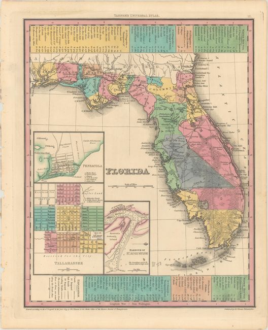
Subject: Florida

Period: 1836 (published)

Publication: A New Universal Atlas

Color: Hand Color

Size:
10.9 x 13.6 inches
27.7 x 34.5 cm
Download High Resolution Image
(or just click on image to launch the Zoom viewer)

This is an early example of Tanner's map of Florida showing towns, railroads, forts, roads, canals, major rivers, and lakes. The large Indian Reservation in the center of the peninsula is marked by an Indian Boundary Line to the west and south and an Unidentified Indian Boundary Line to the east. Several land grants are also noted, including those of Arredondo, Miranda, Delespine, and Fleming, which had been granted by the Spanish government prior to ceding the territory of Florida to the United States in 1821. There are three inset maps detailing Pensacola, Tallahassee, and St. Augustine. The map reflects the configuration of counties in 1832 with the recent organization of Franklin and Columbia Counties. Water routes from St. Augustine and Pensacola to various ports are described above and below the map. Although dated 1833, this map first appeared in Tanner's 1835 Atlas of the United States and was reissued in the first edition of his New Universal Atlas in 1836.

References:

Condition: A

Full original color on paper with a "B&W" watermark. Clean and bright with two tiny spots in the inset of St. Augustine.

Estimate: $400 - $500

Sold for: $300

Closed on 6/14/2017

Archived