Catalog Archive
Auction 163, Lot 247

"Asher & Adams' Arkansas and Portion of Indian Territory", Asher & Adams

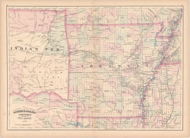
Subject: Arkansas & Indian Territory

Period: 1871 (circa)

Publication: New Columbian Rail Road Atlas and Pictorial Album of American Industry

Color: Hand Color

Size:
22.9 x 15.9 inches
58.2 x 40.4 cm
Download High Resolution Image
(or just click on image to launch the Zoom viewer)

This detailed atlas map extends beyond Arkansas to show parts of Indian Territory, northeastern Texas, northern Louisiana, southern Missouri, northwestern Mississippi, and the southwestern corner of Tennessee. The county configuration is current to 1871, with Clay County still called Greene and the appearance of new counties Lincoln, Nevada, and Sarber. Much of the Indian Territory shown here is dominated by the Choctaws. The copyright date below the bottom neatline reads "187", with the specific year left blank. Possibly published in Asher & Adams' new Commercial, Topographical, and Statistical Atlas and Gazetteer of the United States... or Asher & Adams' New Columbian Rail Road Atlas and Pictorial Album of American Industry.

References:

Condition: B+

There is faint scattered foxing, minor offsetting, and light toning that is most pronounced along the sheet's edges.

Estimate: $120 - $150

Unsold

Closed on 6/14/2017

Archived