Catalog Archive
Auction 163, Lot 239

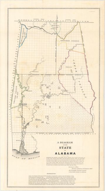
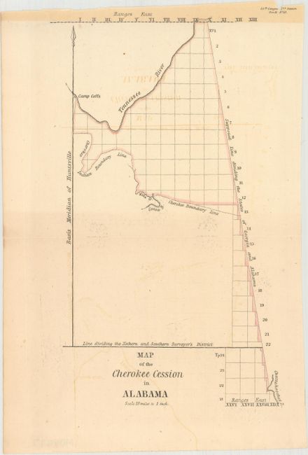
"[Lot of 2] A Diagram of the State of Alabama [and] Map of the Cherokee Cession in Alabama", U.S. Government

Subject: Alabama

Period: 1840 (dated)

Publication:

Color: Hand Color

Size:
11.7 x 22.6 inches
29.7 x 57.4 cm
Download High Resolution Image
(or just click on image to launch the Zoom viewer)

A. A Diagram of the State of Alabama, from Senate Doc. 61, 26th Congress, 2nd Session, dated 1840. An early General Land Office state map that shows surveying progress to 1840. There is no county development, but the settlements of Mobile, Montgomery, Cahaba, St. Stephens, Demopolis, Huntsville, Tuscaloosa, and Sparta are located. Large Indian Cession lands are shown including those of the Creek, Choctaw, Chickasaw, and Cherokee. Huntsville is located in the Old Madison County. Signed in the plate, "Surveyor's Office, Florence Alabama 25th. January 1840. Jas. H. Weakley Surveyor General of the Public Lands in Alabama." Engraved by W.J. Stone. Condition: Issued folding with light scattered foxing and a bit of offsetting. There is a tiny fold separation in the top blank margin.

B. Map of the Cherokee Cession in Alabama, from Senate Doc. 11, 25th Congress, 2nd Session, published 1837. This small map delineates the lands allotted to the Cherokees in Alabama. The area is wedged between the Tennessee River and the Supposed Line Dividing the States of Georgia and Alabama. Condition: There is light offsetting and toning that is especially pronounced along the top edge of the sheet. A tiny chip appears at top right.

References: Claussen & Friis #179 & #371; Phillips (M) p. 226.

Condition: B+

See description above.

Estimate: $170 - $200

Unsold

Closed on 6/14/2017

Archived