Catalog Archive
Auction 163, Lot 231

"Colton's Map of California, Nevada, Utah, Colorado, Arizona & New Mexico", Colton, Joseph Hutchins

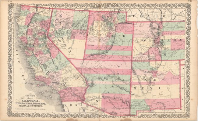
Subject: Southwestern United States

Period: 1855 (dated)

Publication: General Atlas

Color: Hand Color

Size:
26.3 x 16.8 inches
66.8 x 42.7 cm
Download High Resolution Image
(or just click on image to launch the Zoom viewer)

This map of the Southwest features the Pacific Railroad which is shown only partially completed just entering Utah, with the "proposed route" extending westward. Arizona Territory encompasses the southern tip of Nevada and has its first six counties, including Castle Dome and Ewell, which were laid out by the provisional territory government in 1860. The Utah/Nevada border still extends to 115 degrees, and Wyoming is labeled "Idaho." The Pony Express route is shown, as is the Mail Route. The map has exceptional information on railroads, both built and planned. It is filled with place names, information on topography and watershed, and numerous notes. For example, one note in west central Colorado states "Elevated plain, fertile, gently rolling with fresh water, lakes and timber." Fancy titling and decorative scroll-style border.

References: Wheat (TMW) #1200.

Condition: B+

Original color with light toning along the centerfold, an archivally repaired centerfold separation at bottom, and two stains in the bottom blank margin. There are a number of tiny tears along the edges of the sheet.

Estimate: $220 - $250

Sold for: $160

Closed on 6/14/2017

Archived