Catalog Archive
Auction 163, Lot 230

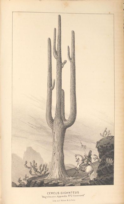
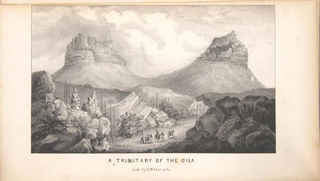
"Military Reconnaissance of the Arkansas, Rio del Norte and Rio Gila... [with] Notes of a Military Reconnoissance, from Fort Leavenworth, in Missouri...", Emory, William Hemsley

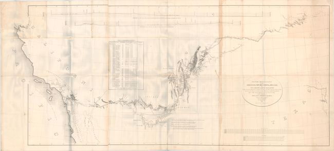
Subject: Southwestern United States

Period: 1848 (published)

Publication: Sen. Ex. Doc. 7, 30th Congress, 1st Session

Color: Black & White

Size:
67.8 x 30.1 inches
172.2 x 76.5 cm
Download High Resolution Image
(or just click on image to launch the Zoom viewer)

An important Mexican-American War period map that shows the route of Col. Kearny and his Army of the West as they traveled from Ft. Leavenworth to Los Angeles via Santa Fe and San Diego. Wheat states that the map was an important milestone in the cartographic development and accurate determination of the geography of the West. A large map printed on three sheets, joined as issued.

The map is accompanied by the Senate edition of Emory's important report documenting the 1846-1847 journey. Emory's reports are enjoyable reads and this is no different, with passages such as "I stopped in the little town of Isoletta, to visit my friend, the accolade, who has the reputation, Indian though he be, of being the most honest man and best maker of brandy in the territory." The report summarizes the activity of the U.S. Army of the West after the capture of New Mexico with important early views of the region. It is illustrated with 26 lithographed views, three battle maps, and 14 botanical plates. The important view of San Diego is present. The battle plans are: Sketch of the Actions fought at San Pasqual in Upper California…; Sketch of the Passage of the Rio San Gabriel...; and Sketch of the Battle of Los Angeles Upper California. Fought between the Americans and Mexicans Jany. 9th, 1847. Complete with the two page report (Appendix No. 7) by P. St. Geo. Cooke, Major 2d Dragoons. Printed by Wendell and Van Benthuysen. This is the second edition printed, and thus did not originally contain the large folding map by Emory, which was included in the first and third editions. 416 pages, 40 plates, and 3 single-page maps. Octavo, hardbound in brown cloth covers with original paper label on spine.

References: Wagner & Camp #148:2; Howes #E145; Wheat (TMW) #544.

Condition: B+

Map is in very good condition with moderate toning along the joint and a vertical fold opposite the joint, as well as very light toning along the right side of the map. There are archival tissue repairs on verso to a few short separations along the folds as well as to four small holes, the largest of which is in an unengraved area in northern California. The plates are in very good condition with light scattered foxing and minor toning along the edges. The text is light toned with occasional foxing. The signatures are loose in several spots but the covers and spine are still firmly attached. The covers and spine are lightly worn.

Estimate: $400 - $500

Sold for: $300

Closed on 6/14/2017

Archived