Catalog Archive
Auction 163, Lot 224

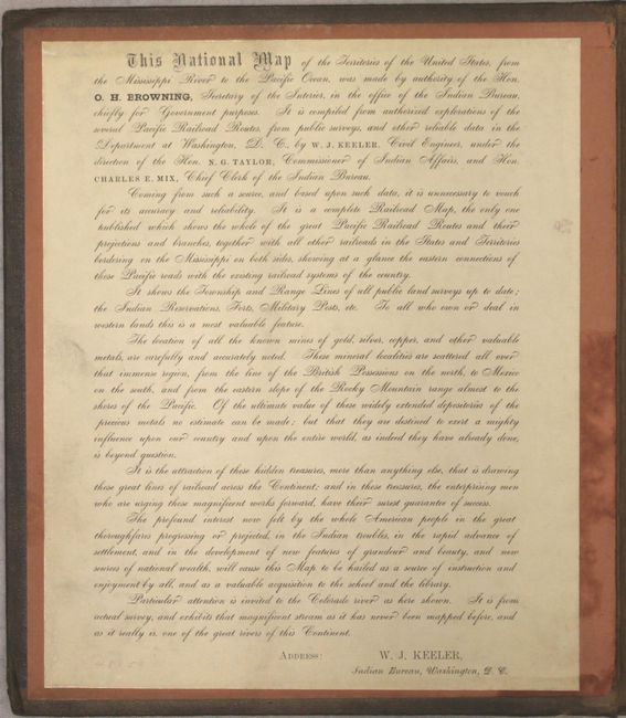
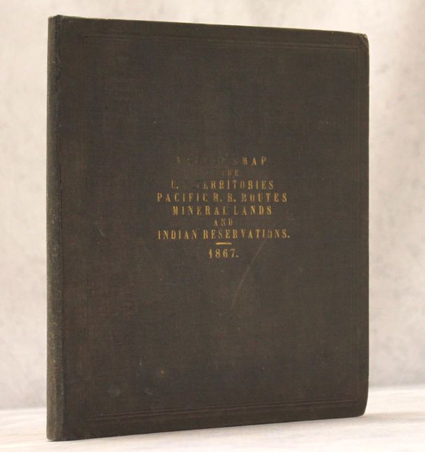
Large Folding Railroad Map with Detail on Mining and Indian Reservations

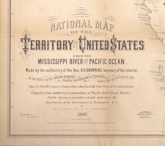
"National Map of the Territory of the United States from the Mississippi to the Pacific Ocean...", Keeler, William J.

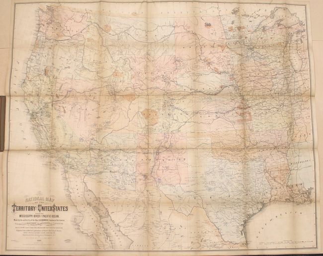
Subject: Western United States

Period: 1867 (dated)

Publication:

Color: Hand Color

Size:
57.6 x 47.5 inches
146.3 x 120.7 cm
Download High Resolution Image
(or just click on image to launch the Zoom viewer)

A fascinating and rarely offered railroad map with an accompanying note by Keeler. The map extends east just past the Mississippi River and shows excellent information on railroads, land offices, Surveyor General's office, forts, military posts, and the location of ores and minerals. A colored key identifies the areas of the west that contain gold, silver, copper, quicksilver (mercury) and coal. Also illustrated are the township and range lines of the public land surveys. This map is also important for its documentation of Indian Reservations, whose lands are shown in orange, but are not listed in the key. The largest of these Indian Reservations is the "Tabequache Utes Indian Res." in western Colorado and the "Uintah Valley Reserve" in eastern Utah. Regarding this map, Wheat says, "Keeler’s large and imposing map is of almost unmanageable size, but it offers something of interest in every part of the West and is worth wrestling with." This map is similar to Keeler’s reduced sized Map of the Routes of the Union Pacific Railroads with Their Eastern Connections..., also published in 1867. A scarce issue. Mounted on linen, the map folds into hard, brown cloth covers with embossing and gilt titling on front cover.

Keeler's note, which is pasted on the inside front cover, notes: "TParticular attention is invited to the Colorado River as here shown. It is from actual survy , and exhibits that magnificent stream as it has never been mapped before, and as it really is, one of the great rivers of this Continent." Despite these claims, there had not yet been a survey of the Colorado River, and its presentation in the map does not show any advances in cartography, and does not yet hint at the existence of the Grand Canyon. Keeler also purports of the "official" nature of the map, both in the title and in his note, however the map was privately printed by Keeler himself and was not a government document.

Keeler's map was one of the largest and most detailed maps of the West at the time and influenced the mapping of the Transmississippi West after the close of the Civil War.

References: Martin & Martin #47; Wheat (TMW) #1170.

Condition: B+

Light toning overall that is more pronounced along the folds, with a number of tiny separations at fold intersections resulting in a couple of tiny areas of loss. There are some fold separations that have extended through the linen and have been archivally repaired on verso. There is minor offsetting of the title at bottom left and a few spots of soiling. The covers are lightly worn and soiled.

Estimate: $4,000 - $5,000

Sold for: $2,250

Closed on 6/14/2017

Archived