Catalog Archive
Auction 163, Lot 198

"Colton's Map of Kansas Nebraska, Dakota & Indian Territory", Colton, Joseph Hutchins

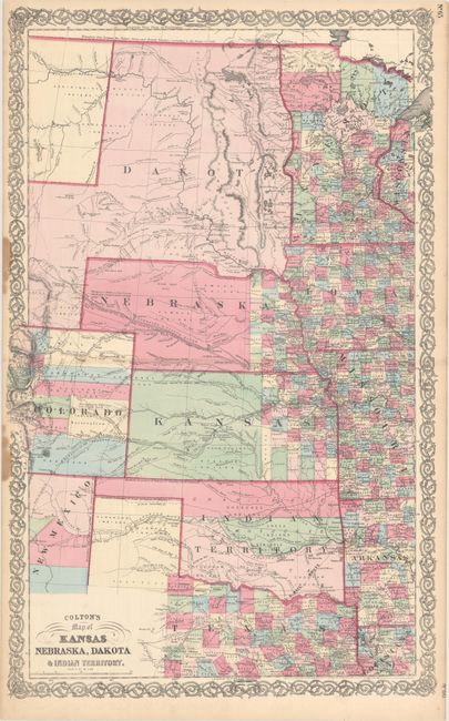
Subject: Central United States

Period: 1855 (dated)

Publication:

Color: Hand Color

Size:
17.1 x 27 inches
43.4 x 68.6 cm
Download High Resolution Image
(or just click on image to launch the Zoom viewer)

This is a scarce map of Central US showing early county configurations and territorial boundaries. The map extends from northern Texas to the border between the US and Canada. Nebraska and Kansas show county development only in the far eastern portion of the state, and New Mexico and Colorado show very early county lines. Indian Territory is divided into 3 large reservations, with a number of different tribes noted. Dakota Territory is shown in an odd configuration encompassing part of present-day Wyoming. Montana is not named here. This part of the United States saw rapid growth during this time, as evidenced by the extensions of the Pony Express and US Mail routes, proposed wagon roads, and the proposed route of the Pacific Railroad. The "Great Route to California and Oregon via South Pass" is marked from Omaha to beyond Fort Laramie. Forts are identified with miniature American flags, and the paths of various explorers are also noted, including Fremont, Emory, Peck, and Whipple, among others. This is a scarce issue that only appeared between 1864-66.

References:

Condition: B+

Original color with very light toning along the centerfold and two stains at far left, just entering the map border. There are a few tiny tears along the edges of the sheet, not entering the image.

Estimate: $275 - $350

Sold for: $170

Closed on 6/14/2017

Archived