Catalog Archive
Auction 163, Lot 139

First State

"Partie de l'Amerique Septentrionale, qui Comprend le Cours de l'Ohio, la Nlle. Angleterre, la Nlle York, le New Jersey, la Pensylvanie, le Maryland la Virginie, la Caroline", Robert de Vaugondy, Didier

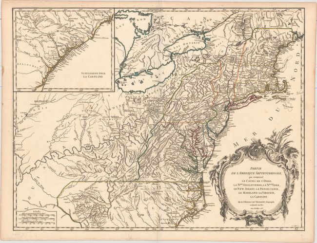
Subject: Colonial New England & Mid-Atlantic United States

Period: 1755 (dated)

Publication: Atlas Universel

Color: Hand Color

Size:
24.6 x 18.9 inches
62.5 x 48 cm
Download High Resolution Image
(or just click on image to launch the Zoom viewer)

Beautifully engraved large map of the colonies between the Ohio and Mississippi rivers and the Atlantic with an inset at upper left that continues the main map from Cape Fear south through the Carolinas and Georgia to F. St. Georges. It is based on the seminal map by John Mitchell that was published in the same year this plate was engraved. The mapping of the trans-Allegheny and Great Lakes regions and in the interior of New England is of particular interest, for this shows some of the earliest accurate information of these regions incorporating data from the Mitchell, Evans and Fry-Jefferson maps. Also of great interest is the region known as the Forks of the Ohio (confluence of the Allegheny and Monomgahela rivers) and the location of French Fort Duquesne – the region hotly disputed during the French and Indian War. It is embellished with a large title cartouche engraved by Marie Catherine Haussard. This is the first state of the map, with "Louisiane" in the western frontier and borders that predate the 1763 Treaty of Paris. It was published in 1757 as part of the first edition.

References: Cumming (SE) #295; McCorkle #755-37; Pedley #469; Sellers & Van Ee #718.

Condition: A

Original outline color on watermarked paper with a few small spots, else fine.

Estimate: $700 - $900

Unsold

Closed on 6/14/2017

Archived