Catalog Archive
Auction 163, Lot 133

"Etats-Unis de l'Amerique du Nord. Limites en 1835", Garnier, Francis Marie Joseph

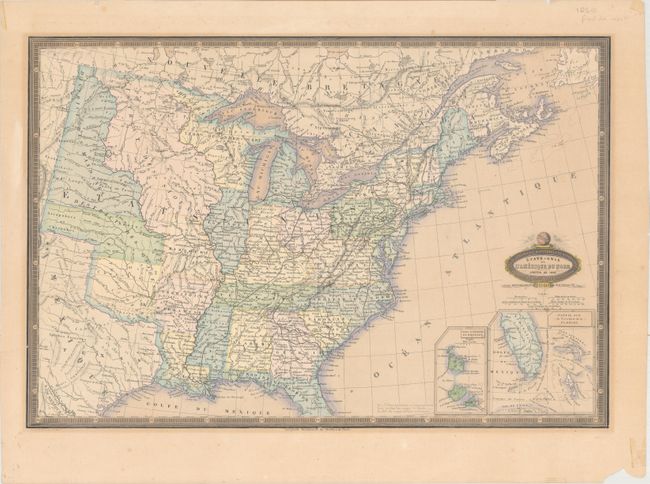
Subject: Eastern United States

Period: 1860 (dated)

Publication: Atlas Spheroidal & Universel de Geographie

Color: Hand Color

Size:
19.7 x 13.3 inches
50 x 33.8 cm
Download High Resolution Image
(or just click on image to launch the Zoom viewer)

This map depicts the state and territory boundaries of the US in 1835, just prior to Texas declaring its independence. Arkansas Territory, which would become a state in 1836, is shown, along with several large Indian districts, including Ozark, Osage, Huron, Sioux, and Mandanes. Two insets depict southern Florida and the islands of Saint Pierre and Miquelon. The map shows the burgeoning railroad system extending west, although none west of the Mississippi River. Having been published in 1860, this map was created to give a historical view of the United States. The is a notation in Texas regarding its annexation to the US in 1845, and another adjacent to the insets indicating the growth of the United States from 24 states in 1840 to 38 states and territories in 1857.

Garnier's Atlas Spheroidal & Universel de Geographie is quite rare and sought-after for its elegant hand coloring, precise engraving, and decorative maps.

References:

Condition: B+

Original color with light toning, a few small spots of foxing, and a short tear that just enters the neatline at left and has been closed on verso with archival tape. There are several small chips and tiny tears along the edges of the sheet, well away from the image.

Estimate: $200 - $240

Sold for: $100

Closed on 6/14/2017

Archived