Catalog Archive
Auction 163, Lot 131

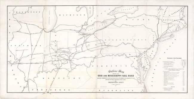
"Outline Map Shewing the Ohio and Mississippi Rail Road Connecting Cincinnati on the Ohio River with St. Louis on the Mississippi River...", Railroad Companies, (Various)

Subject: Eastern United States, Railroads

Period: 1851 (dated)

Publication:

Color: Black & White

Size:
38.9 x 19.3 inches
98.8 x 49 cm
Download High Resolution Image
(or just click on image to launch the Zoom viewer)

This very rare map shows the growing railroad network from the major cities of the northeast west to the Mississippi River. The primary emphasis is on the Ohio & Mississippi Railway which is shown running from Cincinnati to St. Louis (321 miles). A table at lower right indicates distances from Cincinnati to various destinations. Lithographed by Klaupreck & Menzel. Printed on two sheets and joined. While this map was dated 1851, the Ohio and Mississippi Railway actually began service in 1857. In 1893 it was merged with the Baltimore and Ohio Southwestern Railway, and is now part of CSX. Not found in Modelski or Phillips.

References:

Condition: B+

A dark impression on a bright sheet with faint scattered foxing at bottom and numerous fold separations that have been archivally repaired on verso.

Estimate: $350 - $425

Unsold

Closed on 6/14/2017

Archived