Catalog Archive
Auction 163, Lot 122

"United States", Findlay, Alexander

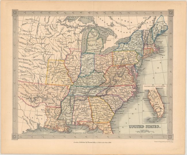
Subject: Eastern United States

Period: 1836 (dated)

Publication:

Color: Hand Color

Size:
9.6 x 7.8 inches
24.4 x 19.8 cm
Download High Resolution Image
(or just click on image to launch the Zoom viewer)

This handsome map of the United States extends to show the eastern part of the Republic of Texas and a vast, unnamed western territory to the northwest of Missouri and Illinois. The map is dated 1836, the same year it would become a state, but Arkansaw appears in an outdated configuration, extending into present-day Oklahoma. Michigan, just a year away from statehood, is named, but Wisconsin is not yet organized. There is excellent detail of rivers and mountains, and many towns and cities are named throughout. An inset at bottom right covers the southern part of Florida. Surrounded by a decorative border. Published in London by Thomas Kelly.

References:

Condition: A

Light toning confined to the sheet edges.

Estimate: $120 - $150

Sold for: $75

Closed on 6/14/2017

Archived