Catalog Archive
Auction 163, Lot 107

Early Travel Guide of the Ohio and Mississippi Rivers

"[2 Volumes] Travels on an Inland Voyage Through the States of New-York, Pennsylvania, Virginia, Ohio, Kentucky and Tennessee...",

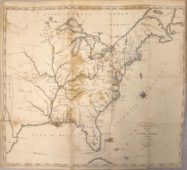
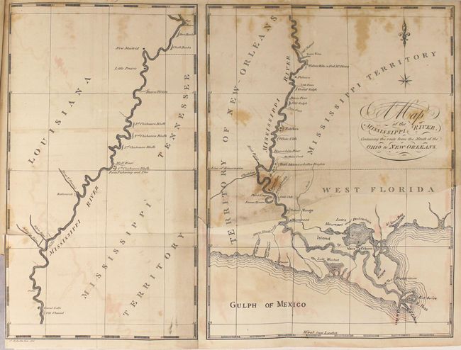
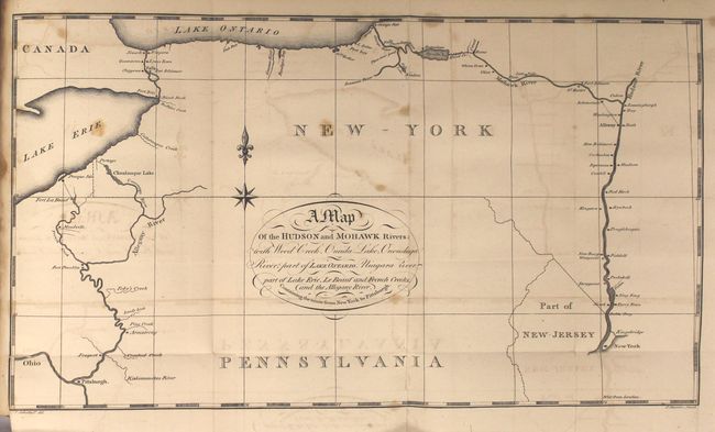
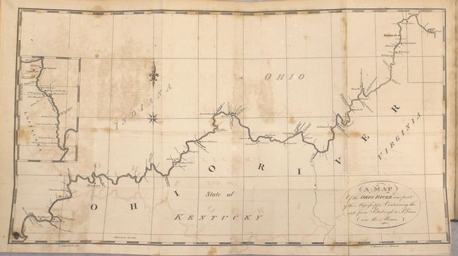
Subject: Eastern United States

Period: 1810 (published)

Publication:

Color: Black & White

Size:
5.3 x 8.5 inches
13.5 x 21.6 cm
Download High Resolution Image
(or just click on image to launch the Zoom viewer)

This two volume travel guide was written by Christian Schultz. It describes Schultz's inland journey from New York state to New Orleans via the Ohio and Mississippi rivers, and is notable for giving an accurate and detailed account of this frontier region. Schultz's book is a compilation of his letters, and was published in direct response to an earlier travel guide written by Englishman Thomas Ashe in 1806. Ashe had traveled on both of these rivers and wrote mostly negative reports, arousing much bitterness among Americans toward British visitors. The two volumes are illustrated by 2 plates and 5 folding maps (see images) including:

Map of the United States Including Louisiana (18.6 x 16.4"). The map extends beyond the Mississippi River to past the 100th meridian. Depicts a large Mississippi Territory occupying present-day Alabama and Mississippi, and a large Indiana Territory comprised of Wisconsin and eastern Minnesota. Florida is divided between East & West. The map locates numerous forts and mines along the Ohio and Mississippi rivers. Condition: There is a 7.5" binding tear at right that has been closed on verso with paper tape.

Map of the Mississippi River Containing the Route from the Mouth of the Ohio to New-Orleans (13.0 x 9.7"). Two separate maps on one sheet. Condition: The bottom right quarter of the map has torn away and has been restated in facsimile. (C+)

A Map of the Hudson and Mohawk Rivers... (13.2 x 7.5").

A Plan of the Ruins of the Ancient Fortifications at Marietta (7.6 x 7.7").

Map of the Ohio River and Part of the Mississippi Containing the Route from Pittsburgh to St. Louis and the Mines (16.0 x 8.75").

Howes describes the account as the "best description of this region at the period." Volume one (207 page) has 4 folding maps and 2 plates. Volume two (224 pages) has 1 folding map. Octavo, hardbound in original quarter calf over marbled boards.

References: Howes #S202; Sabin #78003.

Condition: B

The maps range from fair to very good with light to moderate foxing, light offsetting and mild toning. See description above for additional details on the maps. Text is generally clean and bright with an occasional spot of foxing. The hinges are starting, the spines have minor cracking, and the covers have light wear and soiling.

Estimate: $2,200 - $2,500

Sold for: $1,600

Closed on 6/14/2017

Archived