Catalog Archive
Auction 162, Lot 90
"[Lot of 2] Amerique Septentrionale [and] Etats Unis", Arrowsmith, Aaron, Sr.
Subject: North America
Period: 1813 (circa)
Publication: Nouvel Atlas Universel-Portatif...
Color: Hand Color
Size:
See Description
Download High Resolution Image
(or just click on image to launch the Zoom viewer)
(or just click on image to launch the Zoom viewer)
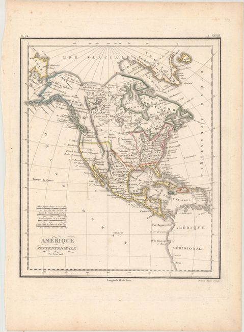
A. Amerique Septentrionale (8.2 x 9.8"). This handsome map features an ambiguous western border between the United States and Canada. East of the Mississippi, the states are identified. Florida is divided into West Florida and East Florida. The area west of the Mississippi is divided into Louisiane and , which includes Texas, and filled with the names of Indian tribes. Alaska is depicted at the tip of the Aleutian Islands in Amerique Russe. In Canada references to the explorers Foxe, Hearn, and Mackenzie appear. Engraved by Semen.
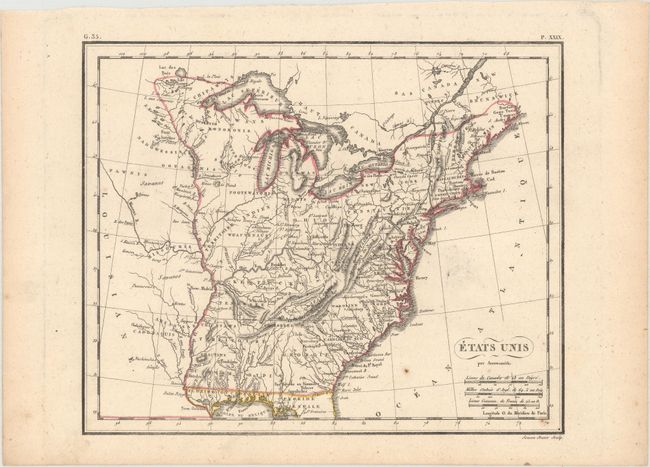
B. Etats Unis (9.9 x 8.2"). This map of the young United States shows the Mississippi River as its western boundary. It features a new Mississippi Territory occupying present-day Alabama and Mississippi. A large nameless Northwest Territory occupies the region north of Kentucky and west of Ohio. Numerous Indian tribes are named and located. Also engraved by Semen.
B. Etats Unis (9.9 x 8.2"). This map of the young United States shows the Mississippi River as its western boundary. It features a new Mississippi Territory occupying present-day Alabama and Mississippi. A large nameless Northwest Territory occupies the region north of Kentucky and west of Ohio. Numerous Indian tribes are named and located. Also engraved by Semen.