Catalog Archive
Auction 162, Lot 681

"Le Japon Divise en Soissante et Six Provinces, Cette Carte est Tiree des Cartes des Japonois", Reland, Adrien
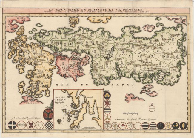
Subject: Japan

Period: 1715 (published)

Publication: Recueil de Voyages au Nord...

Color: Hand Color

Size:
17.8 x 11.9 inches
45.2 x 30.2 cm
Download High Resolution Image
(or just click on image to launch the Zoom viewer)

This first edition map of Japan shows the 66 provinces with both Roman and Sino-Japanese names. It is the first Western-produced map using Japanese cartography and ignoring the prior European use of fictitious names. The inset map of Nagasaki "Vue de la Ville de Nangasacki..." is at lower center and is surrounded by 21 Armories of the Emperor and his shoguns. The map originally published in Recueil de Voyages au Nord, Contenant divers Memoires tres utiles au Commerce & a la Navigation. Tome Troisieme.. by Jean Frederic Bernard.

References: Walter OAG #66.

Condition: A

A clean and bright example on paper with a large coat of arms watermark, issued folding and now flattened. A binding trim at left has been replaced with old paper. The left margin is narrow but ample for framing.

Estimate: $800 - $950

Unsold

Closed on 4/26/2017

Archived