Catalog Archive
Auction 162, Lot 551

"[On 2 Sheets] Carte de l'Empire de Russie, pour Servir a l'Abrege de l'Histoire des Voyages en Europe", Tardieu, Pierre Francois
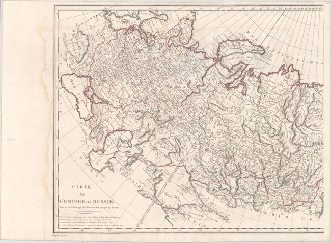
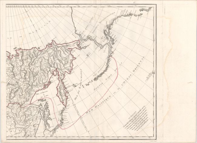
Subject: Russia

Period: 1801 (circa)

Publication:

Color: Hand Color

Size:
24 x 20.8 inches
61 x 52.8 cm
Download High Resolution Image
(or just click on image to launch the Zoom viewer)

This large-scale map, printed on two sheets, covers the entire Russian Empire from the Black Sea to Kamtschatka. It extends to include a portion of mainland Alaska and the Aleutian Islands based upon Russian sources. In the Arctic, a notation along the northern coastline of Nova Zembla concerns the Dutch expedition led by Willem Barents in 1594-96. The map features excellent detail of topography and the river systems in the interior with seven distance scales located in the lower right corner. Drawn by Aubert and engraved by Tardieu. If joined, the map would measure approximately 48 x 21".

References:

Condition: B+

On watermarked paper with light damp staining along the left and right side of both sheets and some extraneous creasing adjacent to the folds. There is a worm track in the right side of the image of the left sheet and a corresponding worm track in the right sheet that is confined to the blank margin. Issued folding.

Estimate: $350 - $425

Sold for: $200

Closed on 4/26/2017

Archived