Catalog Archive
Auction 162, Lot 412

Scarce Map only Published in <i>Historia Mundi</i>

"Mappa Aestivarum Insularum Alias Bermudas Dictarum...", Mercator/Hondius
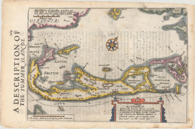
Subject: Bermuda

Period: 1635 (circa)

Publication: Historia Mundi or Mercators Atlas...

Color: Hand Color

Size:
9.1 x 6.5 inches
23.1 x 16.5 cm
Download High Resolution Image
(or just click on image to launch the Zoom viewer)

This is a scarce, small map of Bermuda noting the various tribes along with a number of settlements. Bermuda is shown enlarged in the middle of the north Atlantic Ocean, with Virginia appearing at top left, Plymouth and Cape Cod at top center, and Nova Anglia at top right. The lack of a relative scale in this map gives it a unique appearance. The map is adorned with a compass rose orienting north to the top right and a sinking ship. This map is from the English edition of Mercator's Atlas Minor, which was published under the title Historia Mundi or Mercators Atlas by Michael Spark and Samuel Cartwright. After acquiring the plates to the 1607 edition of the Mercator/Hondius Atlas Minor, Sparke republished the maps with text translated into English by Wye Saltonstall. Sparke also had 41 additional maps engraved for the Historia Mundi, including this map of Bermuda. Most of these maps were copied from Cloppenburg's edition of Atlas Minor, and some were signed by the engravers Jacob van Langren and Ralph Hall. These additional maps only appeared in the 1635, 1637 and 1639 editions of the Historia Mundi and are therefore quite scarce. English text on verso.

References: Van der Krogt (Vol. III) #9660:351 (Sparke).

Condition: B+

A crisp impression with light show-through of text on verso, a few spots of foxing, and a few tiny chips along the edges of the sheet.

Estimate: $700 - $900

Sold for: $500

Closed on 4/26/2017

Archived