Catalog Archive
Auction 162, Lot 399

"A New Chart of Guayana with the Colonies of Cayenne, Surinam, & Trinadad", Heather, William

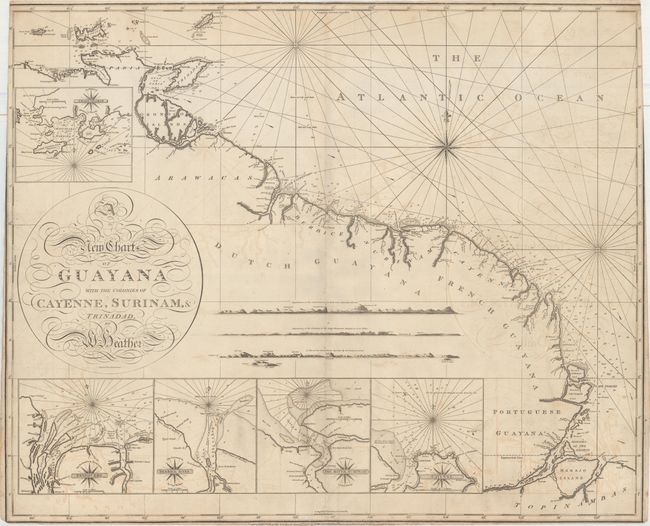
Subject: Guyana, Suriname, French Guiana

Period: 1797 (dated)

Publication:

Color: Black & White

Size:
30.6 x 25.1 inches
77.7 x 63.8 cm
Download High Resolution Image
(or just click on image to launch the Zoom viewer)

This rare, large chart illustrates the coastline from the mouth of the Orinoco River to the mouth of the Amazon River. Soundings are noted along the coast, and numerous rivers are identified heading inland. Five large insets give greater detail of Chaguaramas, on the northwestern tip of Trinidad, and four rivers along the coast of South America: the Essequibo, the Berbice, the Suriname, and the Cayenne. Three panoramic land approach views also fill the interior. The map is adorned with a graceful calligraphic cartouche. Engraved by John Stephenson.

At the end of the 18th century Britain played a leading role in chart making and William Heather was among the most prominent cartographers of the period. He succeeded Mount and Page in 1765 and then established a Naval Academy and the Naval Warehouse, which provided nautical instruments, charts and instructional texts on navigation. Heather later changed the name of his publishing company to "Heather & Williams." This name remained until John William Norie, who began his career working for Heather, took over the company after Heather's retirement and renamed it the J.W. Norie and Company in 1813.

References:

Condition: B

Light offsetting with several short printer's creases adjacent to centerfold at bottom. Narrow bottom margin, with minor loss of publisher's imprint below the neatline. Trimmed along the sides at top, with some loss of neatline.

Estimate: $275 - $350

Sold for: $375

Closed on 4/26/2017

Archived