Catalog Archive
Auction 162, Lot 364

"Isole Antili, la Cuba, e la Spagnuola, Descritta, e Dedicate...", Coronelli, Vincenzo Maria
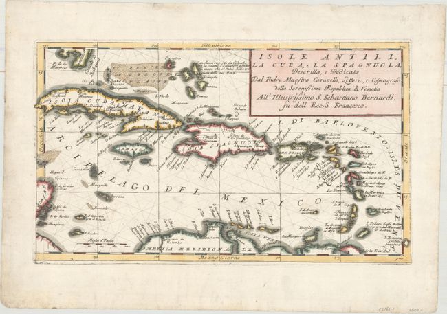
Subject: Caribbean

Period: 1696 (circa)

Publication: Atlante Veneto

Color: Hand Color

Size:
17.1 x 10 inches
43.4 x 25.4 cm
Download High Resolution Image
(or just click on image to launch the Zoom viewer)

Coronelli's scarce map of the Caribbean extends from the southern tip of Florida and the Canale di Bahama to the easternmost Antilles and Trinidad. The detailed map is centered on Hispaniola and includes several smaller islands such as the Caymans, Virgin Islands, and several islands off the Yucatan Peninsula. A note in the Lucayan archipelago of the Bahamas, identifies Guanahani, the native name for the island where Columbus supposedly landed in 1492 and subsequently called San Salvador.

References: Shirley (BL Atlases) T.CORO-13a #214.

Condition: A

The sheet has a short worm track and a couple of small worm holes within the map image, all but one of which have been repaired on verso with archival materials. Additional worm holes and tracks in the top blank margin have been repaired as well.

Estimate: $700 - $850

Sold for: $350

Closed on 4/26/2017

Archived