Catalog Archive
Auction 162, Lot 313

"Wyoming. Compiled by Permission from Official Records in U.S. Land Office", Holt, G.L.
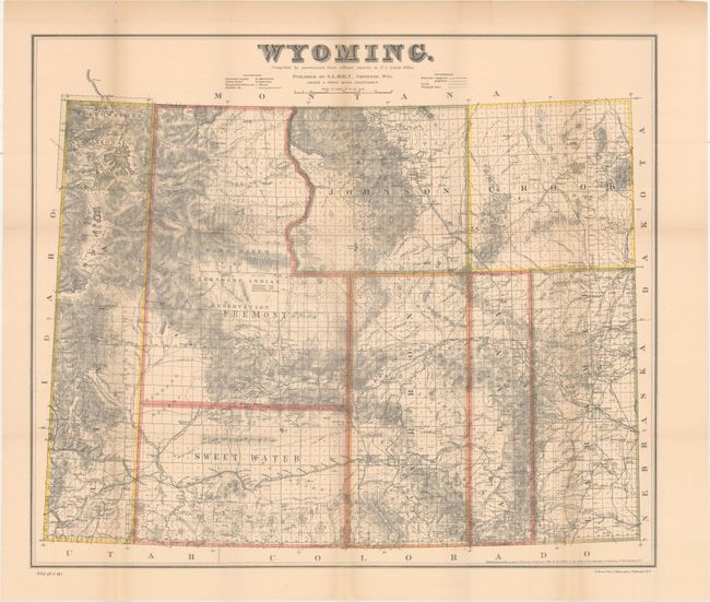
Subject: Wyoming

Period: 1883 (dated)

Publication: H.R. Ex. Doc 1, 49th Congress, 1st Session

Color: Hand Color

Size:
24 x 20.5 inches
61 x 52.1 cm
Download High Resolution Image
(or just click on image to launch the Zoom viewer)

This uncommon map was originally published in Cheyenne, Wyoming. Issued seven years before statehood, it delineates only eight counties. Topography and hydrology are well developed, shows Yellowstone National Park, Shoshone Indian Reservation, towns, railroads, telegraph lines, common roads, and the areas containing coal and gypsum. In 1883 the cattle industry comprised 90% of all commerce, but the brutal winter of 1886-87 dealt a disastrous setback to this limited economy and contributed to delaying statehood. Blevins calls this "fantastic" map the most detailed and accurate of the period because of its scale and sources. Drawn by Frank & Fred Bond and printed by N. Peters, Photo-Lithographers, Washington, D.C.

References: Wheat (TMW) #916; Blevins #426.

Condition: B+

Issued folding with even, light toning and a few faint damp stains along the upper folds.

Estimate: $350 - $450

Sold for: $350

Closed on 4/26/2017

Archived