Catalog Archive
Auction 162, Lot 310

First Engraved Map of Matagorda Bay

"Bahia de S. Bernardo", Direccion de Hidrografia

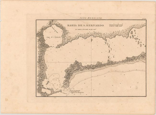
Subject: Matagorda Bay, Texas

Period: 1809 (published)

Publication: Portulano de la America Septentrional

Color: Black & White

Size:
10.2 x 7.2 inches
25.9 x 18.3 cm
Download High Resolution Image
(or just click on image to launch the Zoom viewer)

According to Steeter, this was the first separately engraved map of St. Bernardo Bay (Matagorda Bay). Uncommon, if not rare, it shows the Colorado River emptying in the Lago de S. Bernardo which is connected to the Bay. The narrow entrance to the Gulf of Mexico is flanked by Ila de S. Francisco and Barra de S. Bernardo (Pass Cavallo between Matagorda Island and Matagorda Peninsula). This is the first edition of the map with later editions published in 1818 and 1825. On a scale of 2 miles per inch with "TG" below the bottom neatline.

References: Streeter (Texas) #1044; Phillips (A) #1223.

Condition: B+

There is a diagonal printer's crease at top, mild toning, and light soiling.

Estimate: $700 - $850

Unsold

Closed on 4/26/2017

Archived