Catalog Archive
Auction 162, Lot 261

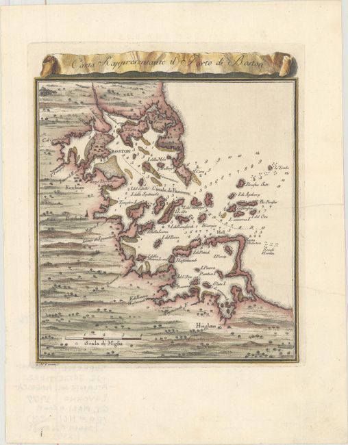
"Carta Rappresentante il Porto di Boston", Masi, Gio. Tommaso

Subject: Boston, Massachusetts

Period: 1777 (circa)

Publication: Atlante dell’America

Color: Hand Color

Size:
7 x 8.3 inches
17.8 x 21.1 cm
Download High Resolution Image
(or just click on image to launch the Zoom viewer)

This scarce Italian-produced map showing the vicinity of Boston Harbor is engraved in typical beautiful Italian style with dark, bold lines. Boston is in the northern third of the map that extends south to include Hingham. The map locates Roxbury, Dorchester, and Cambridge. Coastal towns, harbor features and islands are well mapped and recognizable. Dozens of soundings and the main ship channel are clearly shown. The decorative script title is contained in a scroll banner that floats above the map. A most uncommon issue that was issued between the French and Indian War and the American Revolutionary War. Engraved by Giuseppe Maria Terreni.

References:

Condition: A

A clean and bright example with a couple of minor creases.

Estimate: $300 - $375

Sold for: $170

Closed on 4/26/2017

Archived